IMAGES TAKEN NEAR TO
Oakwellgate, GATESHEAD, NE8 2AU

Introduction

This page details the photographs taken nearby to Oakwellgate, NE8 2AU by members of the Geograph project.

The Geograph project started in 2005 with the aim of publishing, organising and preserving representative images for every square kilometre of Great Britain, Ireland and the Isle of Man.

There are currently over 7.5m images from over14,400 individuals and you can help contribute to the project by visiting https://www.geograph.org.uk

Image Map


Images are licensed for reuse under creativecommons.org/licenses/by-sa/2.0
Notes
  • Clicking on the map will re-center to the selected point.
  • The higher the marker number, the further away the image location is from the centre of the postcode.

Image Listing (1530 Images Found)

Images are licensed for reuse under creativecommons.org/licenses/by-sa/2.0
  • ...
Image
Details
Distance
1
St Mary's Church
St Mary's Church, now the home of the 'Gateshead Visitor Centre'.
Image: © Peter McDermott Taken: 22 Feb 2009
0.00 miles
2
St Mary's Church and the Sage Centre
Viewed from the Tyne Bridge. St Mary's Church dates from the 12th century, and is now a Heritage Centre.
Image: © Paul Franks Taken: 26 May 2012
0.00 miles
3
Gateshead - St. Mary's Church
Home of the Gateshead Visitor Centre.
Image: © Alan Heardman Taken: 11 Apr 2008
0.01 miles
4
St Mary's, Gateshead
A Grade I listed building which is now a heritage centre.
Image: © Bill Boaden Taken: 20 Apr 2017
0.01 miles
5
Old And New
This depicts old and new buildings on the Tyne. St Mary’s Church is one of Gateshead’s oldest and most important historic buildings. Its beautiful, simple and airy interior makes this the perfect venue for a heritage centre devoted to Gateshead’s fascinating past. What’s more, its location high above the Tyne means it offers visitors some of the most spectacular views of Tyneside. Up until 1857, St Mary’s was the only Anglican church in Gateshead. It was also the only place in the borough where people could legally get married. One of Gateshead’s last remaining links to the medieval ages, the church was badly damaged in two separate fires in 1979 and 1983, but was later restored to became an auction room. The Grade I-listed building, perched on the south bank of the Tyne, is now home to the Gateshead Heritage Centre. The Sage music centre can be seen in the background.
Image: © Paul Robson Taken: 10 Jun 2005
0.01 miles
6
St Mary's Heritage Centre, Gateshead
The former Anglican church dates mainly from the 14th century with fragments of the Norman period. The tower was rebuilt in the 18th century, and the chancel in the 19th by John Dobson. Listed grade I (list entry 1248544). I was unable to access the heritage centre on this Saturday afternoon as a wedding reception was about to take place.
Image: © Stephen Craven Taken: 4 Dec 2021
0.01 miles
7
Hillgate explosion
Memorial to an explosion which caused fires along the quayside and sent burning debris across the river to start fires in Newcastle.
Image: © Richard Webb Taken: 7 Mar 2009
0.01 miles
8
Under the Tyne Bridge
Looking towards St Mary's Church and the Sage Centre. The church is now a heritage centre.
Image: © Paul Franks Taken: 26 Sep 2012
0.01 miles
9
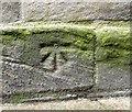
Benchmark on St Mary's Church
Ordnance Survey 1GL Bolt benchmark which is described in detail on the Bench Mark Database at http://www.bench-marks.org.uk/bm35110.
Image: © phil Richards Taken: 15 Jul 2010
0.01 miles
10
King Street, NE1
A "reverse" view is shown in Image (photographed by Alan Heardman).
Image: © Mike Quinn Taken: 13 Sep 2014
0.02 miles
  • ...