
IMAGES TAKEN NEAR TO
WOOLER, NE71 6TH
Introduction
This page details the photographs taken nearby to NE71 6TH by members of the Geograph project.
The Geograph project started in 2005 with the aim of publishing, organising and preserving representative images for every square kilometre of Great Britain, Ireland and the Isle of Man.

There are currently over 7.5m images from over14,400 individuals and you can help contribute to the project by visiting https://www.geograph.org.uk
Image Map
Images are licensed for reuse under creativecommons.org/licenses/by-sa/2.0
Notes
- Clicking on the map will re-center to the selected point.
- The higher the marker number, the further away the image location is from the centre of the postcode.
Image Listing (7 Images Found)
Images are licensed for reuse under creativecommons.org/licenses/by-sa/2.0
Image
Details
Distance
3
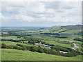
A view to Lanton and beyond
The view from Lanton Hill down to Lanton and the Glen/Till floodplain beyond.
This photograph was taken during a 'socially-distanced' period of exercise during the Coronavirus (COVID-19) pandemic of 2020.
Image: © James T M Towill
Taken: 20 Jun 2020
0.02 miles
4
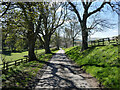
Down to Lanton
On the minor road from Milfield heading down to Lanton in this quiet corner of the Till/Glen floodplain.
This photograph was taken during the Coronavirus (COVID-19) pandemic of 2020/21.
Image: © James T M Towill
Taken: 12 Apr 2021
0.10 miles
5
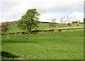
Horses on Lanton Hill
The memorial on Lanton Hill is an obelisk and was erected in about 1827 in memory of John Davison, by his brother Alexander Davison of Swarland.
Image: © Lisa Jarvis
Taken: 22 Apr 2007
0.13 miles
6
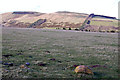
Kirknewton : Ad Gefrin
The land we now know was once Ad Gefrin covers a far larger area than that excavated by Brian Hope-Taylor. As Hope-Taylor wrote in 1969:
"Still, that part of Ad Gefrin which lies to the south of the Wooler-Kirknewton road remains uninvestigated. Outlying buildings of the royal township are manifested annually, whatever the farmer's sowing. More important is the clear indication that excavation would also yield material for elucidation of the shadowy period roughly from 500BC to AD500"
Past Perfect: http://www.pastperfect.org.uk/sites/yeavering/archive/beyond.html
Image: © Ken Bagnall
Taken: 13 Mar 2011
0.20 miles
7
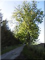
Ash, Lanton
Yellowing leaves in warm Autumn weather beside the road from Milfield.
Image: © Richard Webb
Taken: 29 Sep 2015
0.23 miles