
IMAGES TAKEN NEAR TO
BELFORD, NE70 7HS
Introduction
This page details the photographs taken nearby to NE70 7HS by members of the Geograph project.
The Geograph project started in 2005 with the aim of publishing, organising and preserving representative images for every square kilometre of Great Britain, Ireland and the Isle of Man.

There are currently over 7.5m images from over14,400 individuals and you can help contribute to the project by visiting https://www.geograph.org.uk
Image Map
Images are licensed for reuse under creativecommons.org/licenses/by-sa/2.0
Notes
- Clicking on the map will re-center to the selected point.
- The higher the marker number, the further away the image location is from the centre of the postcode.
Image Listing (10 Images Found)
Images are licensed for reuse under creativecommons.org/licenses/by-sa/2.0
Image
Details
Distance
1
Adderstone Mains
On its own road from the A1.
Image: © Russel Wills
Taken: 17 Feb 2015
0.00 miles
2
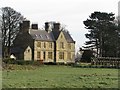
Large house at Adderstone Mains
The large farmhouse at Adderstone Mains. At one time it will have belonged to the owner of the surrounding farmland, now in the modern era of agriculture it is just as likely to have been separated from the land and sold off.
Image: © Graham Robson
Taken: 7 Feb 2015
0.03 miles
3
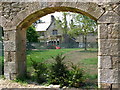
Adderstone House
Adderstone is a township in the parish of Bamburgh, Northumberland in which Adderstone House is the chief residence. There was a lot of building work going on at this time, with a nearby steading conversion.
Image: © Lisa Jarvis
Taken: 11 Jun 2007
0.04 miles
4
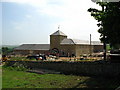
Adderstone Mains
A Northumbria steading development. The most striking feature of the development is the Dovecot Tower.
Image: © Lisa Jarvis
Taken: 11 Jun 2007
0.08 miles
6
Adderstone Mains
Looking towards the converted farm steading of Adderstone Mains.
Image: © Graham Robson
Taken: 7 Feb 2015
0.13 miles
8

Farmland and shed at Adderstone Mains
Looking across farmland towards a modern steel framed agricultural building at Adderstone Mains.
Image: © Graham Robson
Taken: 7 Feb 2015
0.16 miles
9
The road to Adderstone Mains
Through good arable land.
Image: © Russel Wills
Taken: 17 Feb 2015
0.18 miles
10
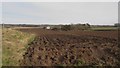
Ploughed field west of Adderstoen Lowmill
A large ploughed arable field to the west of the buildings at Adderstone Lowmill.
Image: © Graham Robson
Taken: 7 Feb 2015
0.21 miles