
IMAGES TAKEN NEAR TO
Waren Mill, BELFORD, NE70 7EE
Introduction
This page details the photographs taken nearby to NE70 7EE by members of the Geograph project.
The Geograph project started in 2005 with the aim of publishing, organising and preserving representative images for every square kilometre of Great Britain, Ireland and the Isle of Man.

There are currently over 7.5m images from over14,400 individuals and you can help contribute to the project by visiting https://www.geograph.org.uk
Image Map
Images are licensed for reuse under creativecommons.org/licenses/by-sa/2.0
Notes
- Clicking on the map will re-center to the selected point.
- The higher the marker number, the further away the image location is from the centre of the postcode.
Image Listing (94 Images Found)
Images are licensed for reuse under creativecommons.org/licenses/by-sa/2.0
Image
Details
Distance
1
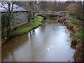
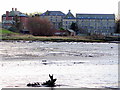
Waren Burn, Waren Mill
Shortly before entering Budle Bay.
Image: © Karl and Ali
Taken: 30 Dec 2013
0.02 miles
2
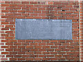
Plaque in wall, Waren Mill
This plaque, which I'm presuming dates from 1925 details the development of the mill on this site. The mill building itself is grade 2 listed and has been converted into apartments.
The plaque reads:
WAREN MILL 1925
WAS CONNECTED WITH THE ROYAL SAXON CITY OF BAMBURGH IN PRE NORMAN TIMES
1187 HISTORICALLY MENTIONED
1605 MILL RACE WAS DERELICT
1788 ADMIRALTY ERECTED MILL FOR WATSON IN RESPONSE TO FARMERS REQUEST FOR AN OUTLET FOR THEIR WHEAT
1819 STEAM INSTALLED FOR GREGSON
1865 HEIGHTENED AND ENLARGED FOR NAIRN
1881 BURNT ON DECEMBER 21ST
1888 RESTORED BY BROWNE (OWNER) FOR SHORT
1918 MACHINERY INSTALLED BY SHORT (OWNER)
1921 MALTING COMPLETED BY SHORT
Image: © Graham Robson
Taken: 18 Sep 2013
0.02 miles
3
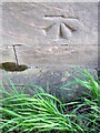
Bench Mark, Waren Mill
The Ordnance Survey bench mark is to be found on the south parapet of the bridge over the Waren Mill. For a view of the bridge Image and for further information on the cut mark and others in the area http://www.bench-marks.org.uk/bm39412
Image: © Maigheach-gheal
Taken: 7 Apr 2011
0.02 miles
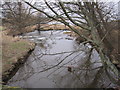
8
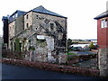
Waren Mill
A water-powered corn mill existed at Waren Mill in 1187. Most of the present mill building dates from the 1780s although some of it is much older. The mill closed in 1980. Waren Mill is a Grade II Listed Building.
Image: © Andrew Curtis
Taken: 12 Dec 2014
0.03 miles
9
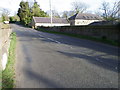
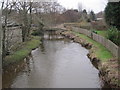
Bridge over the Waren Burn
The bridge carries the B1342 over the Waren Burn.
Image: © Maigheach-gheal
Taken: 7 Apr 2011
0.03 miles
10
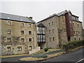
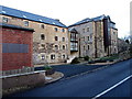
The Mill at Waren Mill
A water-powered corn mill existed at Waren Mill in 1187. Most of the present mill building dates from the 1780s although some of it is much older. Archaeologists think a village once stood around the site of the mill. The mill closed in 1980. Waren Mill is a Grade II Listed Building protected by law.
http://www.keystothepast.info/article/10339/Site-Details?PRN=N5149
After being derelict for years The Mill has now been converted into luxury apartments.
Image: © Les Hull
Taken: 26 Jan 2010
0.03 miles