
IMAGES TAKEN NEAR TO
Harbour Road, SEAHOUSES, NE68 7RN
Introduction
This page details the photographs taken nearby to Harbour Road, NE68 7RN by members of the Geograph project.
The Geograph project started in 2005 with the aim of publishing, organising and preserving representative images for every square kilometre of Great Britain, Ireland and the Isle of Man.

There are currently over 7.5m images from over14,400 individuals and you can help contribute to the project by visiting https://www.geograph.org.uk
Image Map
Images are licensed for reuse under creativecommons.org/licenses/by-sa/2.0
Notes
- Clicking on the map will re-center to the selected point.
- The higher the marker number, the further away the image location is from the centre of the postcode.
Image Listing (886 Images Found)
Images are licensed for reuse under creativecommons.org/licenses/by-sa/2.0
Image
Details
Distance
3
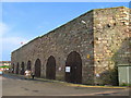
Lime kilns, Seahouses
Late 18th century lime kilns now used as storerooms by fishermen. The lime was loaded directly onto boats and sent to ports along the east coast of Scotland.
Image: © Lisa Jarvis
Taken: 2 Jun 2007
0.01 miles
4
Rain clouds gathering over the harbour, Seahouses
Image: © Andy F
Taken: 18 Jun 2009
0.01 miles
5

Street leading away from Seahouses Harbour
Image: © James Denham
Taken: 15 Jul 2009
0.01 miles

7

Boats in Seahouses Harbour
Several small boats sheltered in one of the harbours at Seahouses.
Image: © DS Pugh
Taken: 24 Oct 2010
0.01 miles

9

The inner harbour at Seahouses with the town beyond
Image: © Andy F
Taken: 18 Jun 2009
0.02 miles
10
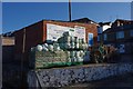
Floats and pots by the slipway at Seahouses Harbour
Image: © Phil Champion
Taken: 28 Apr 2011
0.02 miles