IMAGES TAKEN NEAR TO
Doxford, CHATHILL, NE67 5EA
Introduction
This page details the photographs taken nearby to NE67 5EA by members of the Geograph project.
The Geograph project started in 2005 with the aim of publishing, organising and preserving representative images for every square kilometre of Great Britain, Ireland and the Isle of Man.

There are currently over 7.5m images from over14,400 individuals and you can help contribute to the project by visiting https://www.geograph.org.uk
Image Map (Loading...)


Getting Data...Please wait
Leaflet Map data © OpenStreetMap
Images are licensed for reuse under creativecommons.org/licenses/by-sa/2.0
Notes
- Clicking on the map will re-center to the selected point.
- The higher the marker number, the further away the image location is from the centre of the postcode.
Image Listing (21 Images Found)
Images are licensed for reuse under creativecommons.org/licenses/by-sa/2.0
Image
Details
Distance
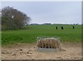
2
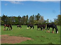
Group of heavy horses
In a field near West Fallodon.
Image: © David Chatterton
Taken: 13 May 2006
0.07 miles
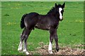
4
Horses and foals
A group of heavy horses.
Image: © David Chatterton
Taken: 25 Jun 2004
0.08 miles
6
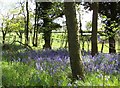
Woodland bluebells
Bluebells in the woods near West Fallodon.
Image: © David Chatterton
Taken: 15 May 2004
0.09 miles
7
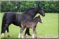
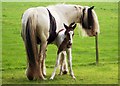
Proud mum
Mother and foal, field near West Fallodon.
Image: © David Chatterton
Taken: 15 Jun 2005
0.09 miles
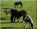
9
Horses in pasture
Beside Kittycarter Burn.
Image: © Russel Wills
Taken: 8 May 2013
0.10 miles
10
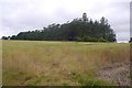
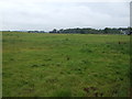
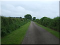
Shaws Plantation
Arable land, Doxford.
Image: © Richard Webb
Taken: 29 Jul 2016
0.12 miles