IMAGES TAKEN NEAR TO
Whittingham, ALNWICK, NE66 4UZ
Introduction
This page details the photographs taken nearby to NE66 4UZ by members of the Geograph project.
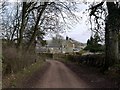
The Geograph project started in 2005 with the aim of publishing, organising and preserving representative images for every square kilometre of Great Britain, Ireland and the Isle of Man.

There are currently over 7.5m images from over14,400 individuals and you can help contribute to the project by visiting https://www.geograph.org.uk
Image Map (Loading...)


Getting Data...Please wait
Leaflet Map data © OpenStreetMap
Images are licensed for reuse under creativecommons.org/licenses/by-sa/2.0
Notes
- Clicking on the map will re-center to the selected point.
- The higher the marker number, the further away the image location is from the centre of the postcode.
Image Listing (12 Images Found)
Images are licensed for reuse under creativecommons.org/licenses/by-sa/2.0
Image
Details
Distance
2
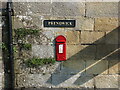
Post Box, Prendwick
This tiny King George V post box is mounted into the exterior wall of a large farm building and lies next to the road signage shown at https://www.geograph.org.uk/photo/6908755. For a selection of detailed free to download walking routes in the area visit www.cheviotwalks.co.uk
Image: © Geoff Holland
Taken: 20 Jul 2021
0.06 miles
3
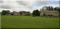
Prendwick
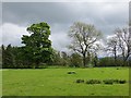
View from the road to the east.
Image: © Richard Webb
Taken: 1 Jun 2013
0.06 miles
4
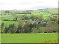
Lane, Prendwick
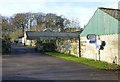
A collection of houses around the big house.
Image: © Richard Webb
Taken: 1 Jun 2013
0.06 miles
5
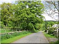
Signage, Prendwick
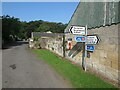
At this point the minor road takes a sharp turn left whilst a Public Bridleway, signed behind the photographer, continues straight on through the gateway. The Pennine Cycleway, Route 68 on the National Cycle Network, passes this way, as indicated on the signage. This route runs in sections between Derbyshire and Northumberland, and is 265 miles in length. For a selection of detailed free to download walking routes in the area visit www.cheviotwalks.co.uk
Image: © Geoff Holland
Taken: 20 Jul 2021
0.06 miles
7
Well adjacent to Prendwick Burn
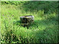
This well, which was marked on the first Ordnance Survey Six-Inch map of the area published in 1866, appears to have been over-flowing freely for many years. It continues to be marked on the current Ordnance Survey 1:25000 scale map of the area. For a selection of detailed free to download walking routes in the area visit www.cheviotwalks.co.uk
Image: © Geoff Holland
Taken: 20 Jul 2021
0.09 miles
10
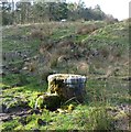
Well beside Prendwick Burn
No need for a bucket on a rope! The water just pours forth.
Image: © Russel Wills
Taken: 6 Apr 2015
0.10 miles