IMAGES TAKEN NEAR TO
High Powburn, ALNWICK, NE66 4HP

Introduction

This page details the photographs taken nearby to High Powburn, NE66 4HP by members of the Geograph project.

The Geograph project started in 2005 with the aim of publishing, organising and preserving representative images for every square kilometre of Great Britain, Ireland and the Isle of Man.

There are currently over 7.5m images from over14,400 individuals and you can help contribute to the project by visiting https://www.geograph.org.uk

Image Map


Images are licensed for reuse under creativecommons.org/licenses/by-sa/2.0
Notes
  • Clicking on the map will re-center to the selected point.
  • The higher the marker number, the further away the image location is from the centre of the postcode.

Image Listing (34 Images Found)

Images are licensed for reuse under creativecommons.org/licenses/by-sa/2.0
  • ...
Image
Details
Distance
1
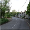
Powburn
Road to Glanton.
Image: © Richard Webb Taken: 1 Jun 2013
0.03 miles
2
Powburn street scene
Opposite the Plough public house, a flower bed with dying daffs, the bus shelter, former local authority housing and a seat in celebration of The Coronation of 1953
Image: © David Clark Taken: 21 Apr 2011
0.03 miles
3
Powburn : High Powburn
Heading off the A697.
Image: © Lewis Clarke Taken: 21 Sep 2020
0.03 miles
4
A697, Powburn
Image: © Alex McGregor Taken: 17 Mar 2013
0.04 miles
5
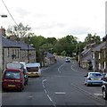
The A697 in Powburn
Heading for Wooler and Coldstream, with the turning for Glanton ahead.
Image: © David Purchase Taken: 6 May 2018
0.05 miles
6
Powburn : A697
Heading through the village of Powburn.
Image: © Lewis Clarke Taken: 21 Sep 2020
0.05 miles
7
Street scene in Powburn
Further research needed but I think this building adjoining the Plough was the Blacksmiths. I prefer the possibility that this building could have been a blacksmiths, bearing in mind the history of The Plough Inn. Keystothepast mention it as a storage or outbuilding for the Plough Inn. http://www.keystothepast.info/durhamcc/K2P.nsf/K2PDetail?readform&PRN=N21851 Found it! There is a book published, Reflections, The Breamish Valley and Ingram, by Sarah Wilson, ISBN 0-9544777-6-6. On page 32 is a copyright photo of the blacksmiths with Billy Prosser, George Lillie (snr) and his brother Jack outside the forge at Powburn. Only 12 months but I found it!
Image: © David Clark Taken: 19 Apr 2011
0.06 miles
8
The Plough at Powburn
Opposite a junction on the busy A687 in the centre of the village of Powburn.
Image: © Oliver Dixon Taken: 27 Jul 2016
0.06 miles
9
Powburn
A junction with the A697.
Image: © Richard Webb Taken: 1 Jun 2013
0.06 miles
10
Junction of the Glanton Road with the A687
In the centre of the village of Powburn.
Image: © Oliver Dixon Taken: 27 Jul 2016
0.07 miles
  • ...