
IMAGES TAKEN NEAR TO
South Road, ALNWICK, NE66 2PH
Introduction
This page details the photographs taken nearby to South Road, NE66 2PH by members of the Geograph project.
The Geograph project started in 2005 with the aim of publishing, organising and preserving representative images for every square kilometre of Great Britain, Ireland and the Isle of Man.

There are currently over 7.5m images from over14,400 individuals and you can help contribute to the project by visiting https://www.geograph.org.uk
Image Map
Images are licensed for reuse under creativecommons.org/licenses/by-sa/2.0
Notes
- Clicking on the map will re-center to the selected point.
- The higher the marker number, the further away the image location is from the centre of the postcode.
Image Listing (82 Images Found)
Images are licensed for reuse under creativecommons.org/licenses/by-sa/2.0
Image
Details
Distance
2
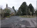
Willowburn Industrial Estate
Lots of mole-hills .... cf Image ... are moles quietly taking over the world?!!
Image: © Barbara Carr
Taken: 21 Mar 2013
0.02 miles
3
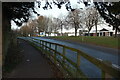
South Road, Alnwick
Looking left from Image] along the A1068. On the right is the turn into the Willowburn Trading Estate. On the left is the boundary wall of Alnwick Cemetery.
Image: © Derek Harper
Taken: 1 Jan 2020
0.02 miles
4
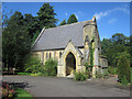
Northern Chapel in Alnwick Cemetery
This is the northern Chapel near the entrance of Alnwick Cemetery. A similar chapel sits on the opposite side of the entrance.
Image: © Graham Robson
Taken: 28 Aug 2012
0.03 miles
5
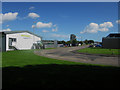
Willowburn Trading Estate, Alnwick
Looking along one of the internal roads in the Willowburn Trading Estate. Premises on the estate are home to a range of organisations and businesses including a Rickerby's, A Claas tractor dealership and a county council works depot.
Image: © Graham Robson
Taken: 28 Aug 2012
0.04 miles
6
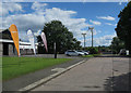
Willowburn Industrial Estate
Hardy, a manufacturer of fishing rods, and a couple of wind turbines.
Image: © Hugh Venables
Taken: 24 Jun 2017
0.05 miles
7

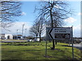
Molehills and wind turbines, Alnwick
The turbines (more clearly shown in Image]) are rather obscured by trees on the green in this view across the A1068 to the Willowburn Trading Estate.
Image: © Derek Harper
Taken: 1 Jan 2020
0.06 miles
8

Alnwick cemetery loopholed wall
Part of the Northern Command: Wooler to Alnwick Stop Line. Constructed 1940-1941.
For further information follow this http://ads.ahds.ac.uk/catalogue/specColl/dob/ai_full_r.cfm?refno=7342
Image: © David Clark
Taken: 3 Mar 2010
0.07 miles
9
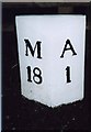
Old Milepost by the A1068, South Road, Alnwick
Cast iron post by the A1068 (was A1), in parish of Alnwick (Alnwick District), opposite the South end of the cemetery, by the bridge, back to footpath by parapet end, on East side of road. MA bevel iron casting, erected by the Cow-causey & Buckton-Burn turnpike trust in the 19th century.
Inscription reads:-
: M / 18 : : A / 1 :
(To Morpeth and Alnwick)
Northumberland HER.
Reference number: N16751 https://www.heritagegateway.org.uk/Gateway/Results_Single.aspx?uid=N16751&resourceID=110
Milestone Society National ID: NB_MPAN18
Image: © IA Davison
Taken: 25 Jan 2004
0.08 miles
10

Old Milepost by the A1068, South Road, Alnwick
Cast iron post by the A1068 (was A1), in parish of Alnwick (Alnwick District), opposite the South end of the cemetery, by the bridge, back to footpath by parapet end, on East side of road. MA bevel iron casting, erected by the Cow-causey & Buckton-Burn turnpike trust in the 19th century.
Inscription reads:-
: M / 18 : : A / 1 :
(To Morpeth and Alnwick)
Northumberland HER.
Reference number: N16751 https://www.heritagegateway.org.uk/Gateway/Results_Single.aspx?uid=N16751&resourceID=110
Milestone Society National ID: NB_MPAN18
Image: © Ian Elsworth
Taken: 18 Oct 2025
0.08 miles