IMAGES TAKEN NEAR TO
ALNWICK, NE66 2LQ
Introduction
This page details the photographs taken nearby to NE66 2LQ by members of the Geograph project.
The Geograph project started in 2005 with the aim of publishing, organising and preserving representative images for every square kilometre of Great Britain, Ireland and the Isle of Man.

There are currently over 7.5m images from over14,400 individuals and you can help contribute to the project by visiting https://www.geograph.org.uk
Image Map (Loading...)


Getting Data...Please wait
Leaflet Map data © OpenStreetMap
Images are licensed for reuse under creativecommons.org/licenses/by-sa/2.0
Notes
- Clicking on the map will re-center to the selected point.
- The higher the marker number, the further away the image location is from the centre of the postcode.
Image Listing (12 Images Found)
Images are licensed for reuse under creativecommons.org/licenses/by-sa/2.0
Image
Details
Distance
1
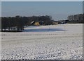
Heckley High House
Heckley High House, located north of Alnwick in Northumberland, is a mixed family farm, concentrating on arable & Aberdeen Angus beef.
The Proof of the Pudding is definitely in the tasting! Discover the delicious taste of yummy puddings, genuinely home made in a tiny farm house kitchen in rural Northumberland. http://www.theproofofthepudding.co.uk/home.html
Image: © Russel Wills
Taken: 17 Jan 2013
0.01 miles
2
Heckley High House from across the fields
The timeless rolling farmland is only a short distance from the bustling market town of Alnwick.
Image: © Sally Holmes
Taken: 6 Aug 2005
0.07 miles
3
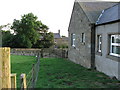
Heckley High House
Looking towards Heckley High House from alongside one of the farm cottages. The farm is a mixed farm of both arable land and livestock.
Image: © Sally Holmes
Taken: 14 Aug 2006
0.10 miles
4
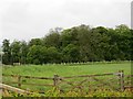
Field off Hinding Lane
Near Heckley High House.
Image: © Richard Webb
Taken: 1 Jun 2013
0.10 miles
5
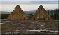
Heckley High House
Straw bales at Heckley High House Farm.
Image: © Peter McDermott
Taken: 30 Dec 2011
0.11 miles
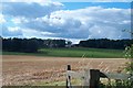
6
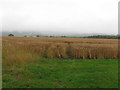
Wet Wheat
A field of wheat to the south of Hinding Lane. On a clear day there are good views of the hills between Alnwick and Rothbury.
Image: © Sally Holmes
Taken: 18 Aug 2006
0.19 miles
8
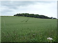
Crop field towards woodland
Off Hinding Lane.
Image: © JThomas
Taken: 30 Jun 2016
0.20 miles
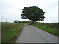
9
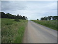
Looking east on Hinding Lane
Towards the B6341 and Alnwick.
Image: © JThomas
Taken: 30 Jun 2016
0.20 miles
