
IMAGES TAKEN NEAR TO
Kirkleatham Gardens, NEWCASTLE UPON TYNE, NE6 5US
Introduction
This page details the photographs taken nearby to Kirkleatham Gardens, NE6 5US by members of the Geograph project.
The Geograph project started in 2005 with the aim of publishing, organising and preserving representative images for every square kilometre of Great Britain, Ireland and the Isle of Man.

There are currently over 7.5m images from over14,400 individuals and you can help contribute to the project by visiting https://www.geograph.org.uk
Image Map
Images are licensed for reuse under creativecommons.org/licenses/by-sa/2.0
Notes
- Clicking on the map will re-center to the selected point.
- The higher the marker number, the further away the image location is from the centre of the postcode.
Image Listing (23 Images Found)
Images are licensed for reuse under creativecommons.org/licenses/by-sa/2.0
Image
Details
Distance
1
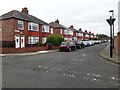
Faldon Side, Heaton, Newcastle upon Tyne
Flats masquerading as semi-detached houses on Faldon Side in Heaton.
Image: © Graham Robson
Taken: 7 Jun 2020
0.06 miles
2

Looking west along the Coast Road, Walkergate
Looking west along the A1058 from its junction with Benfield Road and Red Hall Drive.
Image: © Graham Robson
Taken: 20 Mar 2020
0.09 miles
3

Traffic on Benfield Road, Newcastle upon Tyne
A queue of vehicles waiting to turn right onto the A1058 Coast Road.
Image: © Road Engineer
Taken: 3 Feb 2007
0.09 miles
4
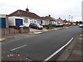
Redcar Road, Heaton, Newcastle upon Tyne
One of several adjacent streets in Heaton where semi-detached bungalows are the predominant house type.
Image: © Graham Robson
Taken: 7 Jun 2020
0.12 miles
6
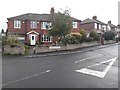
Houses, Turbinia Gardens, High Heaton, Newcastle upon Tyne
A pair of houses at the southern end of Turbinia Gardens in High Heaton. All the houses on the street, and parallel streets are of the same age and style.
Image: © Graham Robson
Taken: 19 Jun 2020
0.15 miles
7
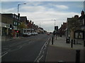
Chillingham Road North
Commerce melts into residential at the North end of this popular suburban stretch.
Image: © MSX
Taken: 9 Oct 2005
0.16 miles
8
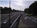
Coast Road/Chillingham Road Slip Road
The A1053 runs from Newcastle upon Tyne to the locally fabled Billy Mill Roundabout near New York [sic] close to North Shields.
Image: © MSX
Taken: 9 Oct 2005
0.16 miles
9
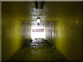
Coast Road Underpass
Amazingly pristine subway (save a few Autumn leaves) linking Heaton with Cochrane Park.
Image: © MSX
Taken: 9 Oct 2005
0.16 miles
10
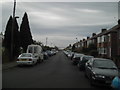
Addycombe Terrace (Facing South)
Possibly the longest predominantly residential street in Newcastle's East End. Post-war semis and bungalows to the North, C.19 Tyneside Terracing to South.
Image: © MSX
Taken: 9 Oct 2005
0.16 miles