
IMAGES TAKEN NEAR TO
Bolingbroke Street, NEWCASTLE UPON TYNE, NE6 5PH
Introduction
This page details the photographs taken nearby to Bolingbroke Street, NE6 5PH by members of the Geograph project.
The Geograph project started in 2005 with the aim of publishing, organising and preserving representative images for every square kilometre of Great Britain, Ireland and the Isle of Man.

There are currently over 7.5m images from over14,400 individuals and you can help contribute to the project by visiting https://www.geograph.org.uk
Image Map
Images are licensed for reuse under creativecommons.org/licenses/by-sa/2.0
Notes
- Clicking on the map will re-center to the selected point.
- The higher the marker number, the further away the image location is from the centre of the postcode.
Image Listing (87 Images Found)
Images are licensed for reuse under creativecommons.org/licenses/by-sa/2.0
Image
Details
Distance
1
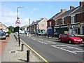
Heaton Park Road Shops
The shopping parade between Cardigan terrace and Falmouth Road. Taken looking toward an entrance to Heaton Park
Image: © Roy Douglas
Taken: Unknown
0.05 miles
2
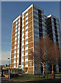
Heaton Park Court, Newcastle-Upon-Tyne
One of the towerblocks in this area.
Image: © wfmillar
Taken: 7 Dec 2008
0.07 miles
3
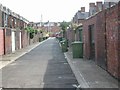
Back lane between Falmouth Road and Heaton Grove
These road were constructed in Edwardian times and are fine examples of the period
Image: © Roy Douglas
Taken: Unknown
0.08 miles
4
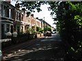
Heaton Grove
The right hand side borders the Main Line from Newcastle to Edinburgh
Image: © Roy Douglas
Taken: Unknown
0.08 miles
5
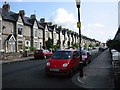
Falmouth Road
One of the finest roads in the locality. The property is Edwardian terrace with a wide separation between the sides
Image: © Roy Douglas
Taken: Unknown
0.08 miles
6

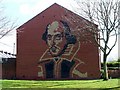
Shakespeare
At the end of a terraced row of houses is an image of Shakespeare. Many of the names of the streets in the surrounding area have links with The Bard.
Image: © Antonia
Taken: 1 Jan 2007
0.10 miles
7
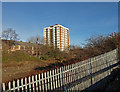
Railway Fence, Newcastle-Upon-Tyne
Heaton Park Court is the towerblock.
Image: © wfmillar
Taken: 7 Dec 2008
0.10 miles
8
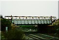
Heaton Park Road Bridge, Newcastle-upon- Tyne
A construction progress photograph taken circa May 1989.
Preparatory works for raising the bridge deck to enable the installation of the overhead electrification cables for the railway track.
Two of the four hydraulic jacks to be used for raising the bridge can be seen at either end of the bridge parapet/bridgedeck.
The wing walls have been carefully taken down to avoid the bridge being snagged whilst being raised.
Behind the steel parapet a Bailey bridge can be seen spanning the existing road bridge, this was used to support the existing utility services that cross the road bridge.
Image]
Image]
Image]
Image]
Image]
Image: © Philip Soakell
Taken: Unknown
0.10 miles
9
End of terrace, South View West
The other end of this short terrace is on Stratford Road.
Image: © Andrew Curtis
Taken: 28 Mar 2010
0.10 miles
10
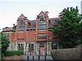
Heaton Library
One of the original 'Carnegie Trust' funded libraries. Now disused in Favour of a modern building on Shields Road
Image: © Roy Douglas
Taken: Unknown
0.11 miles