
IMAGES TAKEN NEAR TO
West Thirston, MORPETH, NE65 9EF
Introduction
This page details the photographs taken nearby to NE65 9EF by members of the Geograph project.
The Geograph project started in 2005 with the aim of publishing, organising and preserving representative images for every square kilometre of Great Britain, Ireland and the Isle of Man.

There are currently over 7.5m images from over14,400 individuals and you can help contribute to the project by visiting https://www.geograph.org.uk
Image Map
Images are licensed for reuse under creativecommons.org/licenses/by-sa/2.0
Notes
- Clicking on the map will re-center to the selected point.
- The higher the marker number, the further away the image location is from the centre of the postcode.
Image Listing (101 Images Found)
Images are licensed for reuse under creativecommons.org/licenses/by-sa/2.0
Image
Details
Distance
1
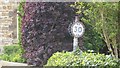
30mph speed limit sign, West Thirston
An old and hard to spot studded sign.
Image: © Richard Webb
Taken: 15 May 2015
0.00 miles
2
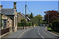
West Thirston
The building in the left foreground is the old school house.
Image: © Paul Franks
Taken: 22 May 2012
0.02 miles
3
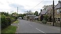
West Thirston
There is an old, studded 30mph speed limit sign beside the road. Was it normal to place them on the right?
Image: © Richard Webb
Taken: 15 May 2015
0.02 miles
4

Road through West Thirston
The road which passes through the small village of West Thirston. An old speed limit sign is attached to a pole on the left of the photo.
Image: © Graham Robson
Taken: 27 Aug 2017
0.02 miles
5

Speed limit sign, West Thirston
An old speed limit sign surviving in West Thirston.
Image: © Graham Robson
Taken: 27 Aug 2017
0.02 miles
7
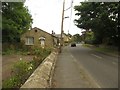
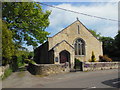
Village street, West Thirston
Looking along the street which runs through the village of West Thirston.
Image: © Graham Robson
Taken: 27 Aug 2017
0.06 miles
8
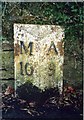
Old Milepost by the B6345, The Peth, Thirston parish
Cast iron post by the B6345 (former A1), in parish of THIRSTON (CASTLE MORPETH District), opposite Peth Foot, The Peth, South of Bridge End, at back of pavement, on Southeast side of road. MA bevel iron casting, erected by the Cow-causey & Buckton-Burn turnpike trust in the 19th century.
Inscription reads:-
: M / 10 : : A / 9 :
(To Morpeth and Alnwick)
Grade II listed.
List Entry Number: 1156282 https://historicengland.org.uk/listing/the-list/list-entry/1156282
Milestone Society National ID: NB_MPAN10.
Image: © IA Davison
Taken: 15 Feb 2004
0.06 miles
10
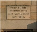
Plaque on house, West Thirston
The houses is near to the eastern end of Felton Old Bridge.
Image: © Humphrey Bolton
Taken: 26 May 2010
0.07 miles