
IMAGES TAKEN NEAR TO
The Causeway, MORPETH, NE65 8BL
Introduction
This page details the photographs taken nearby to The Causeway, NE65 8BL by members of the Geograph project.
The Geograph project started in 2005 with the aim of publishing, organising and preserving representative images for every square kilometre of Great Britain, Ireland and the Isle of Man.

There are currently over 7.5m images from over14,400 individuals and you can help contribute to the project by visiting https://www.geograph.org.uk
Image Map
Images are licensed for reuse under creativecommons.org/licenses/by-sa/2.0
Notes
- Clicking on the map will re-center to the selected point.
- The higher the marker number, the further away the image location is from the centre of the postcode.
Image Listing (50 Images Found)
Images are licensed for reuse under creativecommons.org/licenses/by-sa/2.0
Image
Details
Distance
1
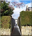
The Cut on Rothbury Road
Through to the Cheviot Lodge housing estate.
Image: © David Clark
Taken: 10 Feb 2010
0.08 miles
2

Bus shelter
Situated on the north side of Rothbury Road.
a useful place to advertise forthcoming events etc.
Image: © David Clark
Taken: 28 Apr 2010
0.09 miles
3
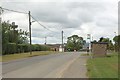
Rothbury Road, Longframlington
The main road running north east to south west through the village. A stone bus shelter stands on the road side.
Image: © Graham Robson
Taken: 21 Jul 2018
0.09 miles
4

Bus stop on Rothbury Road, Longframlington
Buses to Rothbury run via this last village, rather than direct along the B6344.
Image: © Oliver Dixon
Taken: 24 Jun 2011
0.10 miles
5

Cheviot Lodge, Longframlington
The entrance into a 20th Century housing estate off Rothbury Road in Longframlington.
Image: © Graham Robson
Taken: 21 Jul 2018
0.10 miles
7

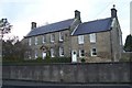
Looking West
From near the junction of Rothbury Road into Cheviot Lodge.
Villa Lane and West lane cottages can be seen to the left, Simonside under snow in the middle distance and No 1 Cheviot Lodge to the right.
Image: © David Clark
Taken: 10 Feb 2010
0.10 miles
8
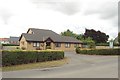
Memorial Hall, Longframlington
A modern community hall taking its name from, and replacing, the early 20th century building Image built after the 1st World War closer to the village centre.
Image: © Graham Robson
Taken: 21 Jul 2018
0.11 miles
9
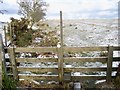
Stile on Public Footpath
On the route of the Devil's Causeway which continues northwards on the right (east) side of the hedge line.
Rigg and furrow can be seen in the photo and after the wet winter the furrows were all water logged today.
Image: © David Clark
Taken: 10 Feb 2010
0.11 miles
10

Show Day
In Longframlington September 2013
Image: © David Clark
Taken: 14 Sep 2013
0.11 miles