
IMAGES TAKEN NEAR TO
Healeycote View, MORPETH, NE65 8BF
Introduction
This page details the photographs taken nearby to Healeycote View, NE65 8BF by members of the Geograph project.
The Geograph project started in 2005 with the aim of publishing, organising and preserving representative images for every square kilometre of Great Britain, Ireland and the Isle of Man.

There are currently over 7.5m images from over14,400 individuals and you can help contribute to the project by visiting https://www.geograph.org.uk
Image Map
Images are licensed for reuse under creativecommons.org/licenses/by-sa/2.0
Notes
- Clicking on the map will re-center to the selected point.
- The higher the marker number, the further away the image location is from the centre of the postcode.
Image Listing (20 Images Found)
Images are licensed for reuse under creativecommons.org/licenses/by-sa/2.0
Image
Details
Distance
1
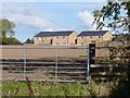
New Build in Longframlington
New 'Social Housing'
Image: © David Clark
Taken: 30 Sep 2014
0.02 miles
2

Winter scene
From the lane to Harecross with Mount pleasant in the distance. The trees on the skyline form the edge of the planting on Longframlington Common.
Image: © David Clark
Taken: 10 Feb 2010
0.03 miles
3
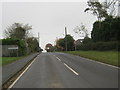
Entering Longframlington from the west
Image: © Peter Robinson
Taken: 23 Oct 2012
0.03 miles
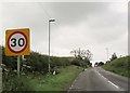
4
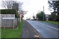
Approaching Longframlington
From the west, up Rothbury Road.
Image: © David Clark
Taken: 7 Nov 2009
0.04 miles
6
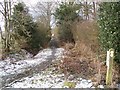
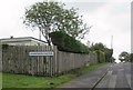
Public Footpath
From Harecross to Cragend.
Image: © David Clark
Taken: 10 Feb 2010
0.06 miles
8
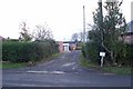
West lane, Longframlington.
West lane is a short row of houses which used to be miners cottages for the nearby colliery. West lane because it runs in a southerly direction, parallel to Villa Lane on the western extremity of Longframlington.
Image: © David Clark
Taken: 7 Nov 2009
0.07 miles
9
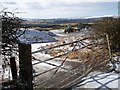
An Idle Tractor
Just outside the village.
Image: © David Clark
Taken: 10 Feb 2010
0.07 miles
10
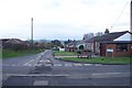
Villa Lane, Longframlington.
The Villa Lane, a minor road leading south out of the village and closely following the line of the Roman Road.
Image: © David Clark
Taken: 7 Nov 2009
0.11 miles