IMAGES TAKEN NEAR TO
High Street, MORPETH, NE65 7TT
Introduction
This page details the photographs taken nearby to High Street, NE65 7TT by members of the Geograph project.
The Geograph project started in 2005 with the aim of publishing, organising and preserving representative images for every square kilometre of Great Britain, Ireland and the Isle of Man.

There are currently over 7.5m images from over14,400 individuals and you can help contribute to the project by visiting https://www.geograph.org.uk
Image Map
Images are licensed for reuse under creativecommons.org/licenses/by-sa/2.0
Notes
- Clicking on the map will re-center to the selected point.
- The higher the marker number, the further away the image location is from the centre of the postcode.
Image Listing (175 Images Found)
Images are licensed for reuse under creativecommons.org/licenses/by-sa/2.0
Image
Details
Distance
1
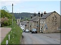
Front Street, Rothbury
The smaller High Street is on the left. This is the approach to the town centre from the west.
Image: © Richard Webb
Taken: 1 Jun 2013
0.01 miles
2
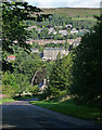
View of Rothbury
Seen from the top of Whitton Bank Road. The prominent central building is Rothbury House on the High Street. Addyheugh on the skyline.
Image: © Stephen Richards
Taken: Unknown
0.01 miles
4
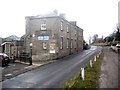
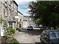
Rothbury House
A RAF Association clubhouse on Rothbury High Street.
Image: © Stanley Howe
Taken: 10 Apr 2013
0.03 miles
5
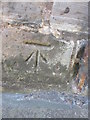
Ordnance Survey Cut Mark
This OS cut mark can be found on the old County Holiday Home building. It marks a point 97.038m above mean sea level.
Image: © Adrian Dust
Taken: 29 Sep 2015
0.03 miles
6
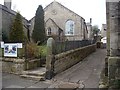
Community Gallery, Rothbury
On the High Street.
Image: © Stanley Howe
Taken: 10 Apr 2013
0.03 miles
7
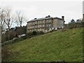
Rothbury House
This was once a hotel and eventually taken over by RAFA for respite care for serving and ex RAF personnel. There is some doubt about its future and at the moment it's closed.
Image: © Les Hull
Taken: 25 Nov 2020
0.04 miles
8
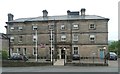
Rothbury House
At the west end of the village is now owned and managed as a convalescent home by the Royal Air Forces Association.
Known locally as the "County" it was originally named "Rothbury Hotel" and opened in 1789 as a private hotel catering to the large number of visitors to the area.
Image: © Russel Wills
Taken: 26 Jun 2012
0.04 miles
9
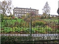
Riverside gardens for Rothbury House
Image: © Peter Robinson
Taken: 23 Oct 2012
0.05 miles