1
View from Rob Roy's Cave
Many Northumbrian caves have a good view; this is an exception.
Image
Image
Image: © Leanmeanmo
Taken: 31 Mar 2017
0.04 miles
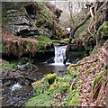
2
Cascade on the Dovecrag Burn
The Dovecrag Burn boasts a number of small waterfalls though, as here, it rarely carries much water. The deep, narrow gorge is littered with fallen and decayed tree limbs which have become permanently trapped, rendering access difficult.
Image: © Leanmeanmo
Taken: 10 Apr 2022
0.05 miles
3
Waterfall on Dovecrag Burn
About 100m downstream of Rob Roy's Cave. The waterfall beside the cave can also be seen in the distance.
Image: © Leanmeanmo
Taken: 31 Mar 2017
0.06 miles
4
Waterfall at Rob Roy's Cave
The cave is immediately to the left of this photo. The Dovecrag Burn boasts a number of small waterfalls though, as here, it rarely carries much water. The deep, narrow gorge is littered with fallen and decayed tree limbs which have become permanently trapped, rendering access difficult.
Image: © Leanmeanmo
Taken: 10 Apr 2022
0.06 miles
5
Waterfall on Dovecrag Burn south of Campville
I photographed this waterfall after an unsuccessful attempt to find Rob Roy's Cave, shown near this location on the 1:25 000 OS map. The stream is in a deep gorge at this point and the banks are slippery and rather overgrown.
Image: © Andrew Curtis
Taken: 11 Sep 2009
0.06 miles
6
Rob Roy's Cave
Like many Northumbrian caves it’s more of an overhang than a true cave. Close to the water but a decent size. Small waterfalls and many fallen trees make access difficult via the Dovecrag Burn and both sides of the gorge are high and steep.
Image
Image: © Leanmeanmo
Taken: 31 Mar 2017
0.06 miles
7
Rob Roy's Cave interior
Like many Northumbrian caves it’s more of an overhang than a true cave. Close to the water but a decent size. Small waterfalls and many fallen trees make access difficult via the Dovecrag Burn and both sides of the gorge are high and steep.
Image
Image: © Leanmeanmo
Taken: 31 Mar 2017
0.06 miles
8
Overhanging sandstone rock formation
Towering over the gorge near Rob Roy's cave
Image: © Leanmeanmo
Taken: 31 Mar 2017
0.07 miles
9
Storm Arwen brought down many trees
Some of the trees are being 'recycled' as firewood!
Image: © Russel Wills
Taken: 12 May 2022
0.15 miles
10
Waterfalls on the Dovecrag Burn
Just upstream of Rob Roy's Cave. The Dovecrag Burn boasts a number of small waterfalls though, as here, it rarely carries much water.
Image: © Leanmeanmo
Taken: 10 Apr 2022
0.15 miles


