IMAGES TAKEN NEAR TO
Charles Road, MORPETH, NE65 0RD
Introduction
This page details the photographs taken nearby to Charles Road, NE65 0RD by members of the Geograph project.
The Geograph project started in 2005 with the aim of publishing, organising and preserving representative images for every square kilometre of Great Britain, Ireland and the Isle of Man.

There are currently over 7.5m images from over14,400 individuals and you can help contribute to the project by visiting https://www.geograph.org.uk
Image Map
Images are licensed for reuse under creativecommons.org/licenses/by-sa/2.0
Notes
- Clicking on the map will re-center to the selected point.
- The higher the marker number, the further away the image location is from the centre of the postcode.
Image Listing (6 Images Found)
Images are licensed for reuse under creativecommons.org/licenses/by-sa/2.0
Image
Details
Distance
1
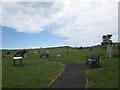
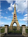
Historic cemetery at Amble
Overlooking the beach.
Image: © James Denham
Taken: 28 Jun 2014
0.19 miles
2
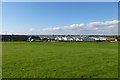
Towards the caravan park
Looking across Links Road to the caravan park in Amble.
Image: © DS Pugh
Taken: 2 Sep 2014
0.21 miles
3
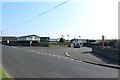
Entrance to Amble Links Caravan Park
The Main entrance off Links Road into a large caravan park on the edge of Amble.
Image: © Graham Robson
Taken: 26 Aug 2019
0.22 miles
4
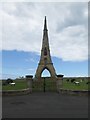
Impressive monument at Amble East Cemetery
The monument was an entrance to the cemetery with chapels on either side but the chapels were demolished in 1971 leaving the entrance.
Image: © James Denham
Taken: 28 Jun 2014
0.23 miles
5
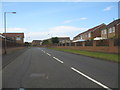
Percy Drive in Amble
Percy, the famoua name of the Earls of Northumberland and though the lined died out in the 17th. century, the name lives on in the county, in so many ways, not least in the names of streets.
Image: © James Denham
Taken: 3 Aug 2012
0.23 miles