
IMAGES TAKEN NEAR TO
Dolphin Court, MORPETH, NE65 0BS
Introduction
This page details the photographs taken nearby to Dolphin Court, NE65 0BS by members of the Geograph project.
The Geograph project started in 2005 with the aim of publishing, organising and preserving representative images for every square kilometre of Great Britain, Ireland and the Isle of Man.

There are currently over 7.5m images from over14,400 individuals and you can help contribute to the project by visiting https://www.geograph.org.uk
Image Map
Images are licensed for reuse under creativecommons.org/licenses/by-sa/2.0
Notes
- Clicking on the map will re-center to the selected point.
- The higher the marker number, the further away the image location is from the centre of the postcode.
Image Listing (5 Images Found)
Images are licensed for reuse under creativecommons.org/licenses/by-sa/2.0
Image
Details
Distance
1
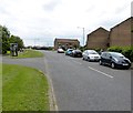
Town Centre end of Percy Drive Amble
Looking SE.
Image: © David Clark
Taken: 3 Jun 2014
0.17 miles
2
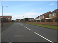
Percy Drive in Amble
Percy, the famoua name of the Earls of Northumberland and though the lined died out in the 17th. century, the name lives on in the county, in so many ways, not least in the names of streets.
Image: © James Denham
Taken: 3 Aug 2012
0.19 miles
3
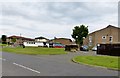
Amble Community Sports Development Centre
Formerly The Amble Boys Club. (White building to left of 'photo.Situated of the roundabout that joins Percy Drive (in front of photographer) with Percy Street and Church Street.
Image: © David Clark
Taken: 3 Jun 2014
0.23 miles
4
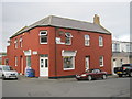
The Harbour Fish Bar in Broomhill Street Amble
Image: © Peter Robinson
Taken: 25 Oct 2012
0.24 miles
5

Fourways, Amble
Crossroads in the centre of Amble. The Newcastle to Alnwick bus comes to here and then turns round and goes back up the road and on to Warkworth.
Image: © Robert Graham
Taken: 4 Jul 2012
0.24 miles