
IMAGES TAKEN NEAR TO
Old Coastguard Cottages, MORPETH, NE65 0AY
Introduction
This page details the photographs taken nearby to Old Coastguard Cottages, NE65 0AY by members of the Geograph project.
The Geograph project started in 2005 with the aim of publishing, organising and preserving representative images for every square kilometre of Great Britain, Ireland and the Isle of Man.

There are currently over 7.5m images from over14,400 individuals and you can help contribute to the project by visiting https://www.geograph.org.uk
Image Map
Images are licensed for reuse under creativecommons.org/licenses/by-sa/2.0
Notes
- Clicking on the map will re-center to the selected point.
- The higher the marker number, the further away the image location is from the centre of the postcode.
Image Listing (191 Images Found)
Images are licensed for reuse under creativecommons.org/licenses/by-sa/2.0
Image
Details
Distance
1
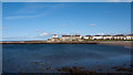
Amble - Little Shore
Little Shore is a small, sandy bay near to the mouth of the River Coquet; the South Jetty extends fully across the open end of the bay but being on piles allows normal tidal movements.
Image: © Trevor Littlewood
Taken: 13 Jun 2011
0.01 miles
2
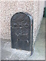
Old Boundary Marker
Harbour Boundary Marker on the northwest side of Bay View, at the rear of No. 6 The Coastguard Houses. Amble by the Sea parish. BOUNDARY / W H C (Warkworth Harbour Commissioners) in raised lettering. Grade II Listed details https://historicengland.org.uk/listing/the-list/list-entry/1041893.
Milestone Society National ID: NB_AMBLE02em
Image: © Mike Rayner
Taken: 6 Oct 2020
0.01 miles
3
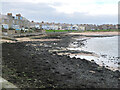
Shore near South Jetty, Amble
Looking from the eastern arm of the jetty.
Image: © Jim Barton
Taken: 11 Nov 2022
0.02 miles
4
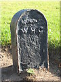
Old Boundary Marker
Harbour Boundary Marker on the inland side of the pedestrian walkway at the foot of the cliffs northwest of the old coastguard houses. Amble by the Sea parish. BOUNDARY / W H C (Warkworth Harbour Commissioners) in raised lettering. Grade II Listed details https://historicengland.org.uk/listing/the-list/list-entry/1304090.
Milestone Society National ID: NB_AMBLE03em
Image: © Mike Rayner
Taken: 6 Oct 2020
0.02 miles
5
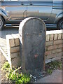
Old Boundary Marker
Harbour Boundary Marker against the front garden wall of No. 5 on the northwest side of Bay View. Amble by the Sea parish. BOUNDARY / W H C (Warkworth Harbour Commissioners) in raised lettering. Grade II Listed details https://historicengland.org.uk/listing/the-list/list-entry/1041892. See also https://www.geograph.org.uk/photo/5463096.
Milestone Society National ID: NB_AMBLE01em
Image: © Mike Rayner
Taken: 6 Oct 2020
0.03 miles
7
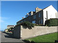
Bay View terraced houses overlooking Amble Harbour
Image: © Peter Robinson
Taken: 7 Oct 2010
0.03 miles
8

Pan Point
From the South Jetty.
Coquet Island in the distance.
Image: © Russel Wills
Taken: 8 Mar 2012
0.03 miles
10

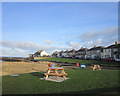
'Big Puffin', Paddlers Park, Amble
This sculpture, by Ben Greenwood, is a giant neolithic faux stone puffin and sits within Paddlers Park close to the coast. The work is part of the Amble Bord Waalk (Bird Walk) Art Trail which consists of 12 individual bird-themed works dotted around the town. The park area was once a sandstone quarry.
Image: © Geoff Holland
Taken: 28 Jul 2025
0.04 miles