
IMAGES TAKEN NEAR TO
Rhodes Street, NEWCASTLE UPON TYNE, NE6 3RA
Introduction
This page details the photographs taken nearby to Rhodes Street, NE6 3RA by members of the Geograph project.
The Geograph project started in 2005 with the aim of publishing, organising and preserving representative images for every square kilometre of Great Britain, Ireland and the Isle of Man.

There are currently over 7.5m images from over14,400 individuals and you can help contribute to the project by visiting https://www.geograph.org.uk
Image Map
Images are licensed for reuse under creativecommons.org/licenses/by-sa/2.0
Notes
- Clicking on the map will re-center to the selected point.
- The higher the marker number, the further away the image location is from the centre of the postcode.
Image Listing (16 Images Found)
Images are licensed for reuse under creativecommons.org/licenses/by-sa/2.0
Image
Details
Distance
1
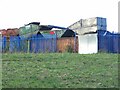
A tip for skips
Seen from Hadrian's Way at Wincomblee.
Image: © Oliver Dixon
Taken: 18 Nov 2008
0.09 miles
2
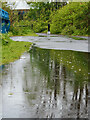
A Paddle along the Hadrian's Wall Path
Image: © Mick Garratt
Taken: 28 Apr 2024
0.12 miles
3
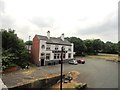
The Crockets Hotel, Walker
On Mitchell Street, which is just west of White Street in Low Walker. Viewed from the Hadrian's Wall Path.
Image: © Robert Graham
Taken: 24 Jul 2013
0.13 miles
4
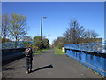
Going in for the kill
With around 85 miles done and only one to go, some are jockeying for the first one to finish.
Image: © Ian S
Taken: 5 Apr 2012
0.13 miles
5
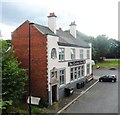
Hadrian's Wall Path: The Crockets Hotel - Walker
From Hadrian's Wall Path
Image: © Anthony Parkes
Taken: 29 Jul 2014
0.14 miles
6
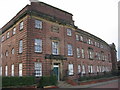
Armstrong Whitworth Shipyard Apprentice School, Walker
Armstrong Whitworth opened the Walker Naval Yard in 1912 and this impressive building is now thankfully restored as office units.
Update: This building was demolished in 2014.
Image: © Alan Fearon
Taken: 5 Nov 2005
0.15 miles
7
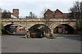
Wincomblee
Old railway bridge at Wincomblee in Walker. The left arch is Mitchell Street, the middle arch is a road leading down under White Street to the works on the Tyne and the right arch is the rear entrance to Wincomblee Workshops.
Image: © Peter McDermott
Taken: 3 May 2008
0.15 miles
8

Wincomblee Road
Seen at its junction with White Street, as viewed from the former railway bridge.
Image: © Bill Boaden
Taken: 20 Apr 2017
0.15 miles
9
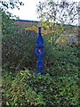
National Cycle Network milepost at Wincomblee
Hadrian's Way is the name given to a largely traffic-free path which runs between western to eastern boundaries of the City of Newcastle. At its eastern end (as here) the Way follows the line of a disused railway. The Way is followed by both Hadrian's Wall National Trail
http://www.nationaltrail.co.uk/hadrianswall/ and by route 72 of the National Cycle Network (Hadrian's Cycleway
http://www.cycle-routes.org/HADRIANSCYCLEWAY/and the Tynemouth branch of the C2C Cycle Route http://www.c2c-guide.co.uk/).
The blue structure is a National Cycle Network milepost
http://www.sustrans.org.uk/default.asp?sID=1132763167625, one of a thousand donated to the NCN project by the Royal Bank of Scotland. This specimen is one of the "Welsh" design by Andrew Rowe, and takes its inspiration from the industrial and nautical heritage of the artist's home in Swansea. An alternative explanation is that it is derived from a Welsh love-spoon. Mileposts are often found painted in different colours according to local initiative.
Image: © Oliver Dixon
Taken: 18 Nov 2008
0.16 miles
10
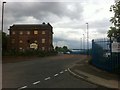
Wincomblee Workshops before being demolished, White Street
Image: © Darrin Antrobus
Taken: 3 Jun 2014
0.17 miles