
IMAGES TAKEN NEAR TO
Merchants Wharf, NEWCASTLE UPON TYNE, NE6 1TR
Introduction
This page details the photographs taken nearby to Merchants Wharf, NE6 1TR by members of the Geograph project.
The Geograph project started in 2005 with the aim of publishing, organising and preserving representative images for every square kilometre of Great Britain, Ireland and the Isle of Man.

There are currently over 7.5m images from over14,400 individuals and you can help contribute to the project by visiting https://www.geograph.org.uk
Image Map
Images are licensed for reuse under creativecommons.org/licenses/by-sa/2.0
Notes
- Clicking on the map will re-center to the selected point.
- The higher the marker number, the further away the image location is from the centre of the postcode.
Image Listing (68 Images Found)
Images are licensed for reuse under creativecommons.org/licenses/by-sa/2.0
Image
Details
Distance
1
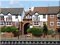
Merchants Wharf
Residential properties overlooking the River Tyne.
Note the cat chasing the seagull up the roof beside the clocktower.
Image: © Russel Wills
Taken: 7 Aug 2014
0.02 miles
2
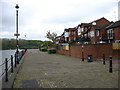
St Peter's Marina Village, by the River Tyne
Seen from the Hadrian's Wall Path, which turns inland at this point.
Image: © David Purchase
Taken: 24 May 2013
0.02 miles
3
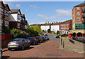
Dobson Crescent
Modern housing development near the River Tyne.
Image: © Bill Boaden
Taken: 20 Apr 2017
0.04 miles
4
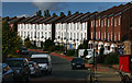
Dobson Crescent
Dobson Crescent in St Peter's.
Image: © Peter McDermott
Taken: 22 Sep 2012
0.05 miles
5
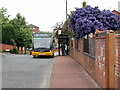
Bottlehouse Street, St Peter's
The blue-flowered shrub in the garden to the right of the bus is a Ceanothus.
Image: © Andrew Curtis
Taken: 3 Jun 2021
0.05 miles
7
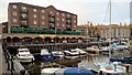
The Merchants Tavern, across St Peter's Marina
From Chandlers Wharf
Image: © Chris Morgan
Taken: 29 Oct 2016
0.05 miles
8
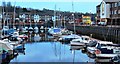
St Peter's Basin
St Peter’s Basin is a private enterprise inner-city marina development of the 1980s. It is in the Byker ward of the city and is very much an upmarket residential enclave in a previously entirely working-class area of the city.
St Peter's is featured as an area on Kaysgeog's site Newcastle Residential Areas: http://newcastleareas.wordpress.com/st-peters/
Image: © Kay Williams
Taken: 24 Feb 2014
0.06 miles
9

New housing at St Peter's
This suburb of Newcastle, on the north bank of the River Tyne was extensively redeveloped in the late 20th century. It had previously been a centre of industry and shipbuilding but had become rundown. On the right can be seen the entrance to the marina, which opened in 1991.
Image: © Robert Graham
Taken: 11 Jul 2013
0.07 miles
10
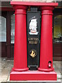
St Peter's Wharf branding
One of several pillars in front of the arcade shops & offices
Image: © Keith Edkins
Taken: 9 Mar 2012
0.07 miles