
IMAGES TAKEN NEAR TO
Walker Road, NEWCASTLE UPON TYNE, NE6 1RN
Introduction
This page details the photographs taken nearby to Walker Road, NE6 1RN by members of the Geograph project.
The Geograph project started in 2005 with the aim of publishing, organising and preserving representative images for every square kilometre of Great Britain, Ireland and the Isle of Man.

There are currently over 7.5m images from over14,400 individuals and you can help contribute to the project by visiting https://www.geograph.org.uk
Image Map
Images are licensed for reuse under creativecommons.org/licenses/by-sa/2.0
Notes
- Clicking on the map will re-center to the selected point.
- The higher the marker number, the further away the image location is from the centre of the postcode.
Image Listing (151 Images Found)
Images are licensed for reuse under creativecommons.org/licenses/by-sa/2.0
Image
Details
Distance
1
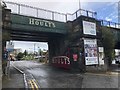
Old Railway Bridge over Entrance to Hoult's Yard
Hoult's Yard was formerly the site of Maling Pottery. Today various period buildings have been renovated for office and business use. The pottery would have send goods out on the railway which passes over the entrance, This was the route of the Riverside branch which formed a loop serving the various industries along the north bank of the Tyne. Today the former railway is a cycle / pedestrian route.
Image: © David Robinson
Taken: 24 Aug 2018
0.05 miles
2
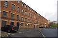
Hoults yard
Hoults yard is situated two miles east of Newcastle city centre in Byker it is a
3 hectare complex built in 1878 specifically for the Maling Pottery establishment. It is a large solidly built structure owned by Hoults Estates Ltd.
Since the 1960s after the closure of Maling Pottery the site provided accommodation for Hoults and floorspace rented out to other local businesses
mainly for manufacturing storage and office uses.
Image: © peter maddison
Taken: 19 Nov 2010
0.07 miles
3

Hoults Yard
Buildings forming part of Hoults Yard in Byker.
Image: © Peter McDermott
Taken: 21 May 2011
0.07 miles
4
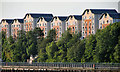
Newcastle Quayside
Flats on St Lawrence Road above Newcastle Quayside.
Image: © Peter McDermott
Taken: 2 Jun 2011
0.07 miles
5
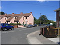
Rodney Street
Leading to St Lawrence Square and Park from Walker Road.
Image: © MSX
Taken: 28 Jul 2006
0.08 miles
6
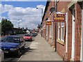
Walker Road Residential
Old fashioned terraced housing on Walker Road. Seemingly all to let.
Image: © MSX
Taken: 1 Aug 2006
0.08 miles
7
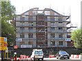
Hawick Industrial Estate
New business units under construction.
Image: © MSX
Taken: 1 Aug 2006
0.08 miles
8
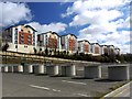
Ouseburn Wharf from Spillers Quay
A brownfield site development on the former John Porter's joinery factory site on St Lawrence Road providing 107 one and two bedroom apartments, and three bed maisonettes,completed in February 2007. Two of the eight blocks are five rather than four stories high which makes them seem a bit uneven.
Image: © Andrew Curtis
Taken: 28 Mar 2010
0.08 miles
9
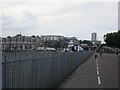
Quayside
The white lines mark route 72 of the National Cycle Network.
Image: © Richard Webb
Taken: 31 Jul 2012
0.08 miles
10
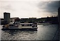
Tyne Countess
Mid Tyne Ferry the 'Tyne Countess'
Heading down the Tyne 'Summer' 1984
During the first 'Tall Ships Race'
It has just past the old 'Baltic Mill'
(outline of the building just showing far right)
At the time Mid Tyne Ferries were owned by Swan Hunter Shipbuilders
And was a 'Workers Ferry' that ran from Hebburn to Walker Naval Yard
Image: © Vin Mullen
Taken: Unknown
0.09 miles