
IMAGES TAKEN NEAR TO
Kingfisher Place, NEWCASTLE UPON TYNE, NE6 1LT
Introduction
This page details the photographs taken nearby to Kingfisher Place, NE6 1LT by members of the Geograph project.
The Geograph project started in 2005 with the aim of publishing, organising and preserving representative images for every square kilometre of Great Britain, Ireland and the Isle of Man.

There are currently over 7.5m images from over14,400 individuals and you can help contribute to the project by visiting https://www.geograph.org.uk
Image Map
Images are licensed for reuse under creativecommons.org/licenses/by-sa/2.0
Notes
- Clicking on the map will re-center to the selected point.
- The higher the marker number, the further away the image location is from the centre of the postcode.
Image Listing (349 Images Found)
Images are licensed for reuse under creativecommons.org/licenses/by-sa/2.0
Image
Details
Distance
1
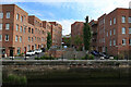
Kingfisher Place & The Malings, Ouseburn
Image: © Andrew Curtis
Taken: 3 Jun 2021
0.01 miles
3
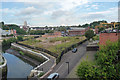
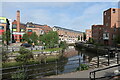
View from Walker Road, Newcastle
A scratchy little corner which must have local property developers salivating. The waterway is Ouse Burn, alongside which is Maling Street.
The tall building, distant left, is probably Shieldfield House.
Much more info on the general area here: Image
Image: © Stephen Richards
Taken: 14 Aug 2012
0.02 miles
6
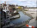
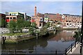
Ouseburn above the Barrage
Taken from the Glasshouse Bridge towards the former Maynard's Toffee Factory with its landmark chimney. Compare the pre-barrage photo from the same location taken in 2006 Image
With renovation of the former Toffee Factory Image, the ruined warehouse building in the foreground, on the west bank of the Ouseburn, was demolished. It could have been used to store hay and feedstocks brought in by boat for the nearby Cattle Sanatorium http://www.twsitelines.info/Siteline.nsf/SMR/2068121C1B40460B802576AF003E6B5B
The building was recorded in 2008 prior to demolition http://www.twsitelines.info/siteline.nsf/SMR/B1801004CB83B345802576AF003EB928
Image: © Andrew Curtis
Taken: 28 Mar 2010
0.03 miles
7
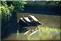
Ouse Burn
Looking down Ouse Burn from the bridge at the bottom of Byker Bank.
Image: © Peter McDermott
Taken: 23 Aug 2008
0.03 miles
8
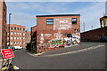
'Ince Building' at corner of Ford & Hume Streets, Ouseburn
R & J Ince were formerly builders and timber merchants. The building is now part of Brinkburn Street Bar & kitchen.
Image: © Andrew Curtis
Taken: 3 Jun 2021
0.03 miles
10
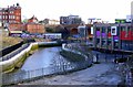
Ouse Burn south from Ouse Street
Shows the River Barrage and the newly developed Toffee Factory on the right Image
Image: © Andrew Curtis
Taken: 19 Feb 2012
0.03 miles