
IMAGES TAKEN NEAR TO
Stannington, MORPETH, NE61 6AP
Introduction
This page details the photographs taken nearby to NE61 6AP by members of the Geograph project.
The Geograph project started in 2005 with the aim of publishing, organising and preserving representative images for every square kilometre of Great Britain, Ireland and the Isle of Man.

There are currently over 7.5m images from over14,400 individuals and you can help contribute to the project by visiting https://www.geograph.org.uk
Image Map
Images are licensed for reuse under creativecommons.org/licenses/by-sa/2.0
Notes
- Clicking on the map will re-center to the selected point.
- The higher the marker number, the further away the image location is from the centre of the postcode.
Image Listing (17 Images Found)
Images are licensed for reuse under creativecommons.org/licenses/by-sa/2.0
Image
Details
Distance
1

Construction site, St Mary's Park, Stannington
A construction site on the new St Mary's Park development near Stannington on the site of the former St Mary's Asylum.
Image: © Graham Robson
Taken: 6 Aug 2016
0.10 miles
2

Disused lodge
Disused lodge at the entrance to St Mary's Hospital.
Image: © Helen Wilkinson
Taken: 10 Jul 2008
0.11 miles
3
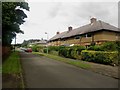
The Villas, Stannington
A street of semi detached houses close to the site of the former St Mary's Hospital which is now being developed into a housing estate.
Image: © Graham Robson
Taken: 3 Jul 2016
0.12 miles
4
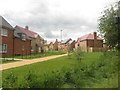
New houses, Stannington Park development
A few of the new houses recently completed as part of the Stannington Park housing development on the site of the former St Mary's Hospital.
Image: © Graham Robson
Taken: 3 Jul 2016
0.13 miles
5
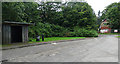
Disused buildings near Stannington
Bus stop and lodge to the former St Mary's Hospital which closed in 1995. Some of the buildings have been demolished and the site is being redeveloped for mixed uses.
Image: © Stephen Richards
Taken: Unknown
0.14 miles
6
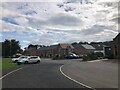
Newly Built Housing, St Mary Lane
Taken from the car park of St Mary's Inn
Image: © Philip Cornwall
Taken: 11 Sep 2021
0.14 miles
7
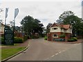
Entrance into Stannington Park
The main entrance into the Stannington Park housing development. The development is taking place on the site of the former St Mary's Hospital, which was originally built in the late 19th Century as the County Asylum for Gateshead. The house by the entrance appears to be the one in Image] which has been given a new lease of life.
Image: © Graham Robson
Taken: 3 Jul 2016
0.16 miles
8
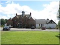
St Mary's Inn, Stannington
The administration block of the former St Mary's Hospital has been retained and converted into an interesting looking restaurant and hotel. The venue opened in 2015 and by mid 2016 the building is still somewhat in the middle of a building site as the surrounding area is redeveloped and houses are being built in place of the old hospital buildings.
Image: © Graham Robson
Taken: 6 Aug 2016
0.17 miles
10
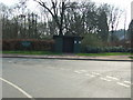
Bus shelter on Green Lane
Served a former hospital - now being developed into housing.
Image: © JThomas
Taken: 9 Apr 2015
0.18 miles