IMAGES TAKEN NEAR TO
Fifth Row, MORPETH, NE61 5SL
Introduction
This page details the photographs taken nearby to Fifth Row, NE61 5SL by members of the Geograph project.
The Geograph project started in 2005 with the aim of publishing, organising and preserving representative images for every square kilometre of Great Britain, Ireland and the Isle of Man.

There are currently over 7.5m images from over14,400 individuals and you can help contribute to the project by visiting https://www.geograph.org.uk
Image Map
Images are licensed for reuse under creativecommons.org/licenses/by-sa/2.0
Notes
- Clicking on the map will re-center to the selected point.
- The higher the marker number, the further away the image location is from the centre of the postcode.
Image Listing (5 Images Found)
Images are licensed for reuse under creativecommons.org/licenses/by-sa/2.0
Image
Details
Distance
1
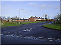
Linton Colliery Village
The entrance to Linton Colliery Village. Sadly the colliery no longer exists.
Image: © george hurrell
Taken: 3 Dec 2006
0.08 miles
2
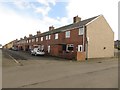
Terraced houses, Linton
One of several rows of brick built terraced houses in the small village of Linton. Most of the village, other than a modern development on its edge consists of a few rows of these old former mineworkers houses.
Image: © Graham Robson
Taken: 6 Mar 2017
0.16 miles
3

M.J. Hickey Plant hire and contracts
On the outskirts of Linton.
Image: © Russel Wills
Taken: 15 Oct 2015
0.19 miles
4
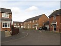
Houses, Foxcover, Linton
A modern housing developing which infill's the gap between the rows of former mineworkers cottages and the road which passes the village, but postdates the original housing.
Image: © Graham Robson
Taken: 6 Mar 2017
0.20 miles