IMAGES TAKEN NEAR TO
Harwood, MORPETH, NE61 4LE
Introduction
This page details the photographs taken nearby to NE61 4LE by members of the Geograph project.
The Geograph project started in 2005 with the aim of publishing, organising and preserving representative images for every square kilometre of Great Britain, Ireland and the Isle of Man.

There are currently over 7.5m images from over14,400 individuals and you can help contribute to the project by visiting https://www.geograph.org.uk
Image Map
Images are licensed for reuse under creativecommons.org/licenses/by-sa/2.0
Notes
- Clicking on the map will re-center to the selected point.
- The higher the marker number, the further away the image location is from the centre of the postcode.
Image Listing (9 Images Found)
Images are licensed for reuse under creativecommons.org/licenses/by-sa/2.0
Image
Details
Distance
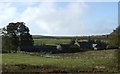
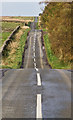
2
Harwood Head
Now facing the vast Harwood Forest.
Green Rigg Wind Farm in the distance.
Image: © Russel Wills
Taken: 6 May 2017
0.01 miles
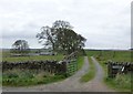
3
Harwood Head
Harwood Head Farm at the head of Harwood Burn.
Image: © Peter McDermott
Taken: 20 Oct 2009
0.02 miles
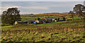
4
Harwood Head
Cottage set back from the Elsdon to Morpeth road.
Image: © Oliver Dixon
Taken: 29 Aug 2007
0.02 miles
5
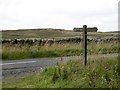
Signpost, Harwood Head
Beyond the road is another example of England's idiotic CRoW act. Identical moorland to this is shaded on the map nearby while this bit is not.
Image: © Richard Webb
Taken: 10 Sep 2015
0.08 miles
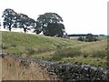
6
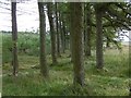
Edge of Harwood Forest
Older trees beside the road at Harwood Head.
Image: © Richard Webb
Taken: 10 Sep 2015
0.08 miles
7
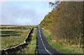
Minor road towards Elsdon
Heading west beside the Harwood Forest.
Image: © JThomas
Taken: 19 Oct 2012
0.09 miles
8
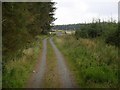
Harwood Road
Looking into the forest from the long straight road along the southern edge.
Image: © Richard Webb
Taken: 10 Sep 2015
0.12 miles
9
Harwood Head
The road to Elsdon at Harwood Head.
Image: © Peter McDermott
Taken: 20 Oct 2009
0.13 miles