
IMAGES TAKEN NEAR TO
North Side, MORPETH, NE61 3SN
Introduction
This page details the photographs taken nearby to NE61 3SN by members of the Geograph project.
The Geograph project started in 2005 with the aim of publishing, organising and preserving representative images for every square kilometre of Great Britain, Ireland and the Isle of Man.

There are currently over 7.5m images from over14,400 individuals and you can help contribute to the project by visiting https://www.geograph.org.uk
Image Map
Images are licensed for reuse under creativecommons.org/licenses/by-sa/2.0
Notes
- Clicking on the map will re-center to the selected point.
- The higher the marker number, the further away the image location is from the centre of the postcode.
Image Listing (9 Images Found)
Images are licensed for reuse under creativecommons.org/licenses/by-sa/2.0
Image
Details
Distance
1
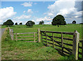
Parkland near Meldon
Mature trees dotted about sparingly, probably laid out in the C19th. This is the other side of road from the house (Meldon Park) itself.
Image: © Stephen Richards
Taken: Unknown
0.07 miles
2
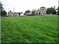
North Side Cottages
Looking up the fields towards North Side cottages.
Image: © Antonia
Taken: 11 Sep 2008
0.08 miles
3

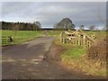
Fields and Woodland near North Side
Countryside near North Side, on the path towards Mill House Farm.
Image: © Antonia
Taken: 11 Sep 2008
0.10 miles
5
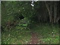
Footpath Through Woodland
Footpath through woodland between North Side and Mill House Farm.
Image: © Antonia
Taken: 11 Sep 2008
0.12 miles
6
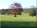
Parkland at Needless Hall
The trees are protected by railings. Polehill Wood beyond.
Image: © Oliver Dixon
Taken: 2 Nov 2015
0.13 miles
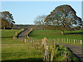
8
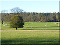
Sheep in parkland near Needless Hall
Polehill Wood beyond.
Image: © Oliver Dixon
Taken: 2 Nov 2015
0.20 miles
9
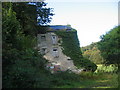
Meldon Mill (ruined)
Keys to the Past Web Site: This building is noted as a corn mill in early mapping of the area. Such sites often changed uses - though still using supplied water power for some length of time. Later maps after the 1st edition Ordnance Survey only state the name of the site. The mill race can be seen to the northwest of the main building coming directly from the river.
Image: © Les Hull
Taken: 26 Sep 2007
0.24 miles