IMAGES TAKEN NEAR TO
Forestborn Court, NEWCASTLE UPON TYNE, NE5 2RH
Introduction
This page details the photographs taken nearby to Forestborn Court, NE5 2RH by members of the Geograph project.
The Geograph project started in 2005 with the aim of publishing, organising and preserving representative images for every square kilometre of Great Britain, Ireland and the Isle of Man.

There are currently over 7.5m images from over14,400 individuals and you can help contribute to the project by visiting https://www.geograph.org.uk
Image Map (Loading...)


Getting Data...Please wait
Leaflet Map data © OpenStreetMap
Images are licensed for reuse under creativecommons.org/licenses/by-sa/2.0
Notes
- Clicking on the map will re-center to the selected point.
- The higher the marker number, the further away the image location is from the centre of the postcode.
Image Listing (24 Images Found)
Images are licensed for reuse under creativecommons.org/licenses/by-sa/2.0
Image
Details
Distance
1
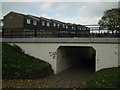
Subway on Earsdon Close
One of many subways under West Denton Way.
Image: © MSX
Taken: 29 Oct 2005
0.10 miles
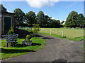
4
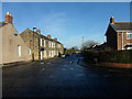
West Denton Way
Housing estate on this busy thoroughfare.
Image: © MSX
Taken: 29 Oct 2005
0.13 miles
6
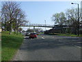
Footbridge over West Denton Way
Heading north east.
Image: © JThomas
Taken: 9 Apr 2015
0.16 miles
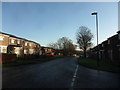
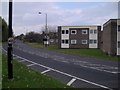
8
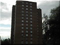
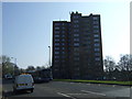
Flats on West Denton Way
Very visible tower block at the start/end of this long road.
Image: © MSX
Taken: 29 Oct 2005
0.17 miles
10
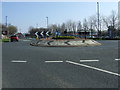
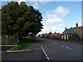
Roundabout on West Denton Way
Heading north east.
Image: © JThomas
Taken: 9 Apr 2015
0.18 miles