
IMAGES TAKEN NEAR TO
Stamfordham Road, NEWCASTLE UPON TYNE, NE5 2LE
Introduction
This page details the photographs taken nearby to Stamfordham Road, NE5 2LE by members of the Geograph project.
The Geograph project started in 2005 with the aim of publishing, organising and preserving representative images for every square kilometre of Great Britain, Ireland and the Isle of Man.

There are currently over 7.5m images from over14,400 individuals and you can help contribute to the project by visiting https://www.geograph.org.uk
Image Map
Images are licensed for reuse under creativecommons.org/licenses/by-sa/2.0
Notes
- Clicking on the map will re-center to the selected point.
- The higher the marker number, the further away the image location is from the centre of the postcode.
Image Listing (37 Images Found)
Images are licensed for reuse under creativecommons.org/licenses/by-sa/2.0
Image
Details
Distance
2
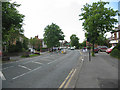
Westerhope
Three or four miles north-west of Newcastle upon Tyne
The photo shows Stamfordham Road, the main road running through the village.
Image: © Chris Tweedy
Taken: 6 Jun 2003
0.07 miles
3
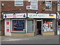
Quinn News, Stamfordham Road / Briarside, NE5
Image: © Mike Quinn
Taken: 22 Mar 2011
0.08 miles
4
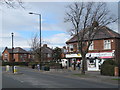
Stamfordham Road, NE5 (B6324)
Shows the location of Image
Image: © Mike Quinn
Taken: 22 Mar 2011
0.09 miles
5
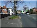
Stamfordham Road (B6324)
Heading north west.
Image: © JThomas
Taken: 9 Apr 2015
0.09 miles
6
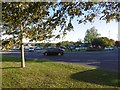
Roundabout, Stamfordham Road
Junction with West Denton Road.
Image: © Richard Webb
Taken: 1 Oct 2015
0.12 miles
7
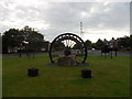
Westerhope Heritage Wheel
Westerhope was the name adopted by the Northern Allotment Society for their village in 1893, as this was to be ‘the hope of the west’. At the same time, neighbouring North Walbottle Colliery sank their shafts. They purchased part of the village to build miners’ houses and so it became a gardeners’ and miners’ village. The colliery closed in 1968, having employed 1300 men and produced 21.5 tons of coal.
The village continues to develop and this mining wheel commemorates and celebrates the mining industry in the North East. The wheel came from Ellington Colliery, the last deep mine to close in the region, and was presented to the community on 2nd August 2008.
Image: © Anthony Foster
Taken: 19 Jul 2014
0.12 miles
8
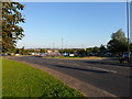
Roundabout at Stamfordham Road/West Denton Way, Westerhope
Image: © Anthony Foster
Taken: 27 Jul 2011
0.12 miles
9
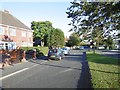
Stamfordham Road
The old alignment, now a residential street. The B6324 has moved to cater for a roundabout.
Image: © Richard Webb
Taken: 1 Oct 2015
0.12 miles
10

Garage, Stamfordham Road
October 2015: Petrol £1:10, Diesel £1.11 per litre.
Image: © Richard Webb
Taken: 1 Oct 2015
0.13 miles