IMAGES TAKEN NEAR TO
Ashleigh Road, NEWCASTLE UPON TYNE, NE5 2BT
Introduction
This page details the photographs taken nearby to Ashleigh Road, NE5 2BT by members of the Geograph project.
The Geograph project started in 2005 with the aim of publishing, organising and preserving representative images for every square kilometre of Great Britain, Ireland and the Isle of Man.

There are currently over 7.5m images from over14,400 individuals and you can help contribute to the project by visiting https://www.geograph.org.uk
Image Map (Loading...)


Getting Data...Please wait
Leaflet Map data © OpenStreetMap
Images are licensed for reuse under creativecommons.org/licenses/by-sa/2.0
Notes
- Clicking on the map will re-center to the selected point.
- The higher the marker number, the further away the image location is from the centre of the postcode.
Image Listing (51 Images Found)
Images are licensed for reuse under creativecommons.org/licenses/by-sa/2.0
Image
Details
Distance
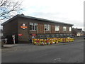
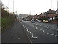
1
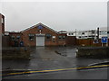
Denton Residents' Association, Denton Burn
Image: © Anthony Foster
Taken: 12 Apr 2015
0.05 miles
3
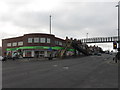
Denton Burn Co-op
There is an inscription between the two central windows of 'NCS 1955' Presumably NCS stands for Newcastle Co-operative Society.
Image: © Anthony Foster
Taken: 1 Mar 2013
0.08 miles
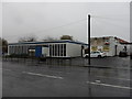
6
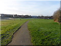
Denton Dene
Denton Burn flows through the Dene in a culvert
Image: © Anthony Foster
Taken: 28 Feb 2014
0.10 miles