IMAGES TAKEN NEAR TO
Columbine Avenue, NE5 1EZ
Introduction
This page details the photographs taken nearby to Columbine Avenue, NE5 1EZ by members of the Geograph project.
The Geograph project started in 2005 with the aim of publishing, organising and preserving representative images for every square kilometre of Great Britain, Ireland and the Isle of Man.

There are currently over 7.5m images from over14,400 individuals and you can help contribute to the project by visiting https://www.geograph.org.uk
Image Map
Images are licensed for reuse under creativecommons.org/licenses/by-sa/2.0
Notes
- Clicking on the map will re-center to the selected point.
- The higher the marker number, the further away the image location is from the centre of the postcode.
Image Listing (27 Images Found)
Images are licensed for reuse under creativecommons.org/licenses/by-sa/2.0
Image
Details
Distance
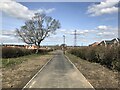
1
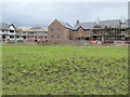
Callerton Rise
Houses nearing completion on the huge (500+) Callerton Rise development.
Image: © Oliver Dixon
Taken: 10 May 2023
0.11 miles
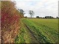
4
Arable field west of Westerhope Golf Course
Image: © Andrew Curtis
Taken: 1 Dec 2013
0.15 miles
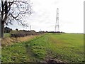
6
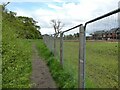
Footpath south of Whorlton Hall
The fencing marks the boundary of the huge new (500+) housing development of Callerton Rise started in 2018. Compare with Image
Image: © Oliver Dixon
Taken: 10 May 2023
0.15 miles
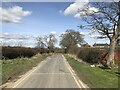
9
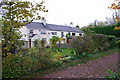
Houses
Row of houses near to Whorlton hall
Image: © peter maddison
Taken: 1 Nov 2010
0.17 miles
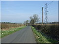
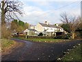
10
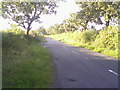
Whorlton Road
Whorlton Road near to the Jingling Gate.
Image: © T simpson
Taken: 26 Aug 2007
0.18 miles