IMAGES TAKEN NEAR TO
Ashdale Crescent, NEWCASTLE UPON TYNE, NE5 1AX
Introduction
This page details the photographs taken nearby to Ashdale Crescent, NE5 1AX by members of the Geograph project.
The Geograph project started in 2005 with the aim of publishing, organising and preserving representative images for every square kilometre of Great Britain, Ireland and the Isle of Man.

There are currently over 7.5m images from over14,400 individuals and you can help contribute to the project by visiting https://www.geograph.org.uk
Image Map (Loading...)


Getting Data...Please wait
Leaflet Map data © OpenStreetMap
Images are licensed for reuse under creativecommons.org/licenses/by-sa/2.0
Notes
- Clicking on the map will re-center to the selected point.
- The higher the marker number, the further away the image location is from the centre of the postcode.
Image Listing (15 Images Found)
Images are licensed for reuse under creativecommons.org/licenses/by-sa/2.0
Image
Details
Distance
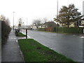
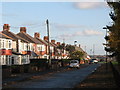
1
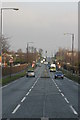
Hillhead Road, Chapel House Estate
Looking north.
Image: © Phil Thirkell
Taken: 9 Jan 2006
0.04 miles
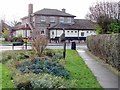
6
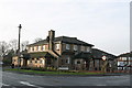
The Peregrine public house, Chapel House Estate
Image: © Phil Thirkell
Taken: 9 Jan 2006
0.16 miles
7
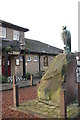
The Peregrine public house, Chapel House Estate
Image: © Phil Thirkell
Taken: 9 Jan 2006
0.16 miles
8
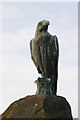
The Peregrine public house, Chapel House Estate
Image: © Phil Thirkell
Taken: 9 Jan 2006
0.16 miles
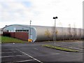
9
Westlands, NE15 (2)
The road lies on the line of Hadrian's Wall - see the map and satellite image http://openspace.nearby.org.uk/wheresthepath.htm?lat=54.98925532516082&lon=-1.7140817642211914&gz=17&oz=10>=1. The site of Turret 8b lies in the foreground.
Image: © Mike Quinn
Taken: 1 Nov 2011
0.17 miles
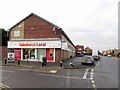
10
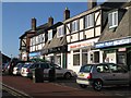
Shops on Hadrian's Wall, West Denton
The road is The Roman Way, NE15 just east of the roundabout on the A69; the road lies on the line of Hadrian's Wall.
Image: © Mike Quinn
Taken: 1 Nov 2011
0.19 miles