
IMAGES TAKEN NEAR TO
Ridgeway, NEWCASTLE UPON TYNE, NE4 9UL
Introduction
This page details the photographs taken nearby to Ridgeway, NE4 9UL by members of the Geograph project.
The Geograph project started in 2005 with the aim of publishing, organising and preserving representative images for every square kilometre of Great Britain, Ireland and the Isle of Man.

There are currently over 7.5m images from over14,400 individuals and you can help contribute to the project by visiting https://www.geograph.org.uk
Image Map
Images are licensed for reuse under creativecommons.org/licenses/by-sa/2.0
Notes
- Clicking on the map will re-center to the selected point.
- The higher the marker number, the further away the image location is from the centre of the postcode.
Image Listing (33 Images Found)
Images are licensed for reuse under creativecommons.org/licenses/by-sa/2.0
Image
Details
Distance
1

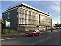
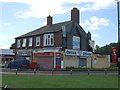
Wingrove House and PDSA Pet Hospital, Cowgate
Image: © Anthony Foster
Taken: 20 Feb 2013
0.15 miles
2

Wingrove House, Ponteland Road, Newcastle
A typical curtain-walled 1960s office block. Shops at street level.
It has not fared well in the intervening years, although Domino's Pizza is still there.
Image: © Stephen Richards
Taken: 19 Jun 2019
0.15 miles
5
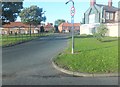
Ponteland Road, Cowgate
Housing and retail area near the A167.
Image: © Barbara Carr
Taken: 15 Sep 2013
0.18 miles
6
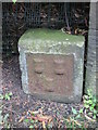
Old Boundary Marker
Estate Boundary Marker beside the left-hand gate pier of Millmount, on the south side of Ponteland Road, Newcastle upon Tyne. The arms of Newcastle are displayed in low relief on its face. After a dispute in 1770 between the Freemen and the Corporation of Newcastle the boundary of the Town Moor was marked. Grade II Listed https://historicengland.org.uk/listing/the-list/list-entry/1106311.
Milestone Society National ID: NB_NEWC02em
Image: © Mike Rayner
Taken: 16 Aug 2019
0.18 miles
7
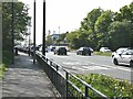
A167 on the Town Moor
A foot and cycle path across a corner of the Town Moor converges on but does not cross the A167 dual carriageway.
Image: © Oliver Dixon
Taken: 27 May 2021
0.18 miles
8
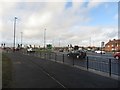
Cowgate junction, Newcastle upon Tyne
A busy road junction at the meeting point of several arterial roads in Newcastle. Until 2016 the junction was a large roundabout. Since then the junction has been altered into a traffic light controlled affair and subways under the roads have been filled in.
Image: © Graham Robson
Taken: 10 Feb 2018
0.18 miles
9
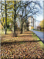
Block of flats in Cowgate
Cowgate is a district of Newcastle upon Tyne north-west of the city centre The apartment block is seen along Ponteland Road which is lined with autumnal, deciduous trees.
Image: © Trevor Littlewood
Taken: 9 Nov 2019
0.19 miles
10
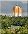
Nuns Moor
Tower block on the edge of Nuns Moor in Newcastle upon Tyne.
Image: © Peter McDermott
Taken: 1 Aug 2010
0.20 miles