IMAGES TAKEN NEAR TO
Grange Road, NEWCASTLE UPON TYNE, NE4 9LD
Introduction
This page details the photographs taken nearby to Grange Road, NE4 9LD by members of the Geograph project.
The Geograph project started in 2005 with the aim of publishing, organising and preserving representative images for every square kilometre of Great Britain, Ireland and the Isle of Man.

There are currently over 7.5m images from over14,400 individuals and you can help contribute to the project by visiting https://www.geograph.org.uk
Image Map
Images are licensed for reuse under creativecommons.org/licenses/by-sa/2.0
Notes
- Clicking on the map will re-center to the selected point.
- The higher the marker number, the further away the image location is from the centre of the postcode.
Image Listing (10 Images Found)
Images are licensed for reuse under creativecommons.org/licenses/by-sa/2.0
Image
Details
Distance
1
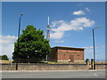
(The site of) Condercum (Benwell) Roman Fort (3)
Most of the fort north of Westgate Road was destroyed when this reservoir was built in the mid-1860s.
Image: © Mike Quinn
Taken: 9 Jun 2008
0.14 miles
2
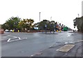
Roundabout on Two Ball Lonnen
The road to the left is Lanercost Drive, and that to the right is Cedar Road.
Image: © Barbara Carr
Taken: 6 Sep 2013
0.16 miles
4
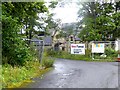
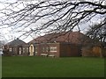
Pendower Hall
Grade II listed building dating from 1867, Pendower Hall has filled a number of functions over the years (see Image). Latterly it was used as an Education Development Centre by Newcastle City Council but has been standing empty for some ten years. Currently under redevelopment as a business and conference centre.
Image: © Oliver Dixon
Taken: 30 Jul 2019
0.17 miles
5
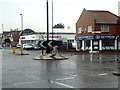
Roundabout on West Road (A186)
At the intersection with Pease Avenue (to the left) and Two Ball Lonnren.
Image: © Oliver Dixon
Taken: 30 Jul 2019
0.21 miles
6
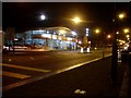
Citroen, West Road
Car showroom at the corner of West Road and Two Ball Lonnen.
Image: © Stephen Sweeney
Taken: 12 Jan 2009
0.21 miles
7
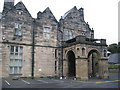
Pendower Hall
Large Grade II listed house, built circa 1870, for J.W. Pease, banker. Used as 10th Northumberland VA Hospital during the First World War. Became a school in 1920 and continued in various educational uses. Sold by the City Council for £815000 in 2015.
Image: © Patrick Brennan - donmouth.co.uk
Taken: 28 Sep 2007
0.21 miles
8
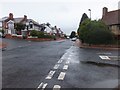
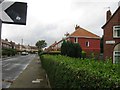
Benwell Hill Road
At the junction with Lemington Gardens. The road to the left is Fox and Hounds Road (the Fox and Hounds is an inn on the West Road close by).
Image: © Barbara Carr
Taken: 6 Sep 2013
0.21 miles
9
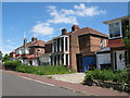
(The site of) Condercum (Benwell) Roman Fort (2)
Most of the fort north of Westgate Road was destroyed when a reservoir was built in the mid-1860s; the southern area was built over between 1926 and 1937.
Image: © Mike Quinn
Taken: 9 Jun 2008
0.23 miles