
IMAGES TAKEN NEAR TO
Bolbec Road, NEWCASTLE UPON TYNE, NE4 9EP
Introduction
This page details the photographs taken nearby to Bolbec Road, NE4 9EP by members of the Geograph project.
The Geograph project started in 2005 with the aim of publishing, organising and preserving representative images for every square kilometre of Great Britain, Ireland and the Isle of Man.

There are currently over 7.5m images from over14,400 individuals and you can help contribute to the project by visiting https://www.geograph.org.uk
Image Map
Images are licensed for reuse under creativecommons.org/licenses/by-sa/2.0
Notes
- Clicking on the map will re-center to the selected point.
- The higher the marker number, the further away the image location is from the centre of the postcode.
Image Listing (38 Images Found)
Images are licensed for reuse under creativecommons.org/licenses/by-sa/2.0
Image
Details
Distance
2
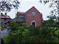
St Robert's Roman Catholic Church
At 151 Cedar Road, Fenham. See http://www.fenham.org.uk/listings/st-robert-of-newminster-rc-church/ .
Image: © Barbara Carr
Taken: 6 Sep 2013
0.09 miles
3
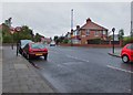
Gowland Avenue. looking towards Nuns Moor Road
After the junction with Nuns Moor Road, Gowland Avenue becomes Bolbec Road.
Image: © Barbara Carr
Taken: 6 Sep 2013
0.10 miles
4

Ordnance Survey Cut Mark
This OS cut mark can be found on the wall of No69 Fenham Hall Drive. It marks a point 107.253m above mean sea level.
Image: © Adrian Dust
Taken: 21 Sep 2024
0.14 miles
5
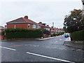
Greywood Avenue
A residential street in the Fenham area of Newcastle.
Image: © Barbara Carr
Taken: 6 Sep 2013
0.15 miles
6
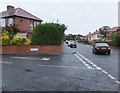
Junction of Severus Road and Gowland Avenue
Residential area, Fenham. (Bit of a Roman theme here, Hadrian and Agricola Roads are close by - this district is very close to the course of Hadrian's Wall and the Benwell Vallum Crossing.)
Image: © Barbara Carr
Taken: 6 Sep 2013
0.17 miles
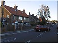
8

Ordnance Survey Cut Mark
This OS cut mark can be found on No49 Curtis Road. It marks a point 104.044m above mean sea level.
Image: © Adrian Dust
Taken: 21 Sep 2024
0.18 miles
9
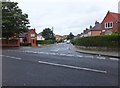
Palm Avenue
Residential street in the Fenham area of Newcastle.
Image: © Barbara Carr
Taken: 6 Sep 2013
0.19 miles
10
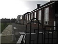
Dame Allan's School
Large private school in the most prosperous corner of Newcastle's West End. See http://en.wikipedia.org/wiki/Dame_Allan's_School,_Newcastle
Image: © MSX
Taken: 29 Oct 2005
0.19 miles