
IMAGES TAKEN NEAR TO
Hampstead Road, NEWCASTLE UPON TYNE, NE4 8TP
Introduction
This page details the photographs taken nearby to Hampstead Road, NE4 8TP by members of the Geograph project.
The Geograph project started in 2005 with the aim of publishing, organising and preserving representative images for every square kilometre of Great Britain, Ireland and the Isle of Man.

There are currently over 7.5m images from over14,400 individuals and you can help contribute to the project by visiting https://www.geograph.org.uk
Image Map
Images are licensed for reuse under creativecommons.org/licenses/by-sa/2.0
Notes
- Clicking on the map will re-center to the selected point.
- The higher the marker number, the further away the image location is from the centre of the postcode.
Image Listing (46 Images Found)
Images are licensed for reuse under creativecommons.org/licenses/by-sa/2.0
Image
Details
Distance
1
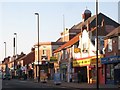
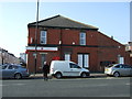
Shops and flats on West Road, NE4
The road lies on the line of Hadrian's Wall.
Image: © Mike Quinn
Taken: 22 Nov 2011
0.06 miles
4
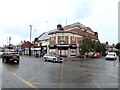
Plaza Cinema as was
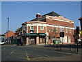
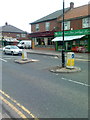
This large cinema at the corner of Gowland Avenue and West Road was built in 1928 but closed in 1960 (see https://www.flickr.com/photos/newcastlelibraries/4079302967 ). It enjoyed a new existence as a Bingo Hall from 1964 to 2005, after which it operated as a pub for a short time. Some small shops occupy the ground floor.
Image: © Oliver Dixon
Taken: 30 Jul 2019
0.06 miles
6
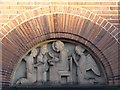
The Church of the Venerable Bede, Benwell Grove, NE4 - bas relief sculpture
The location of this sculpture is shown in Image
Image: © Mike Quinn
Taken: 22 Nov 2011
0.07 miles
7
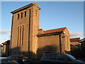
The Church of the Venerable Bede, Benwell Grove, NE4 (2)
The church lies on the (calculated) position of Milecastle 6 on Hadrian's Wall, although no trace of the milecastle has been found. {Source: "Handbook to the Roman Wall" (14th Edition) by J Collingwood Bruce.}
Image: © Mike Quinn
Taken: 22 Nov 2011
0.07 miles
8

Hampstead Road, NE4 (2)
Looking north towards Glebe Street.
Image: © Mike Quinn
Taken: 1 Nov 2011
0.08 miles
9
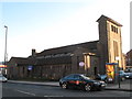
The Church of the Venerable Bede, Benwell Grove, NE4
The church lies on the (calculated) position of Milecastle 6 on Hadrian's Wall, although no trace of the milecastle has been found. {Source: "Handbook to the Roman Wall" (14th Edition) by J Collingwood Bruce.}
Image: © Mike Quinn
Taken: 22 Nov 2011
0.08 miles
10

Hampstead Road, NE4
South of Glebe Street.
Image: © Mike Quinn
Taken: 1 Nov 2011
0.09 miles