
IMAGES TAKEN NEAR TO
Clovelly Avenue, NEWCASTLE UPON TYNE, NE4 8SB
Introduction
This page details the photographs taken nearby to Clovelly Avenue, NE4 8SB by members of the Geograph project.
The Geograph project started in 2005 with the aim of publishing, organising and preserving representative images for every square kilometre of Great Britain, Ireland and the Isle of Man.

There are currently over 7.5m images from over14,400 individuals and you can help contribute to the project by visiting https://www.geograph.org.uk
Image Map
Images are licensed for reuse under creativecommons.org/licenses/by-sa/2.0
Notes
- Clicking on the map will re-center to the selected point.
- The higher the marker number, the further away the image location is from the centre of the postcode.
Image Listing (26 Images Found)
Images are licensed for reuse under creativecommons.org/licenses/by-sa/2.0
Image
Details
Distance
1
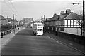
Newcastle trolleybus on Elswick Road - 1966
The building on the right still exists and is sufficiently distinctive to enable the view to be located. The large school building in the distance was demolished relative soon after this view. The trolleybus is one of the final batch of 50 for the system delivered in 1950 and based on similar vehicles built for London Transport. By this stage they were the only type still operating.
For a slide show of British Trolleybuses in the late 60s
http://www.geograph.org.uk/search.php?i=1773236&displayclass=slide
Image: © Alan Murray-Rust
Taken: 25 Mar 1966
0.15 miles
2
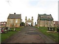
Entrance gates and lodges, St John's Cemetery, Elswick, Newcastle upon Tyne
Two derelict lodges flank the grand entrance into St John's Cemetery. The stonework looks in need of repair and the entrance arch appears to be propped up by metal framework.
Image: © Graham Robson
Taken: 6 Dec 2017
0.17 miles
3
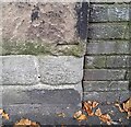
Ordnance Survey Cut Mark
This OS cut mark can be found on the wall east side of Grainger Park Road. It marks a point 112.063m above mean sea level.
Image: © Adrian Dust
Taken: 21 Sep 2024
0.19 miles
4
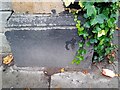
Ordnance Survey Cut Mark
This OS cut mark can be found on the SE side of Bentinck Road. It marks a point 103.272m above mean sea level.
Image: © Adrian Dust
Taken: 21 Sep 2024
0.19 miles
5
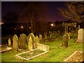
Gravestones in Elswick Cemetery
One of the larger cemeteries in Newcastle. Just off Elswick Road.
Image: © Stephen Sweeney
Taken: 12 Jan 2009
0.20 miles
7
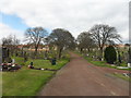
St John's Cemetery, Elswick
Listed Grade II there is a detailed description of the cemetery on Historic England's list entry https://www.historicengland.org.uk/listing/the-list/list-entry/1000761
Image: © Anthony Foster
Taken: 17 Apr 2016
0.22 miles
8
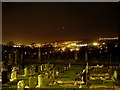
Elswick Cemetery
Looking south across the cemetery towards Gateshead.
Image: © Stephen Sweeney
Taken: 12 Jan 2009
0.22 miles
9
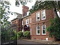
Cherry Tree House, Westgate Road / Grainger Park Road, NE4
Originally "Church House", built in 1880 in Queen Anne style. Formerly diocesan offices, the building currently houses a children's nursery. The building is Grade II listed; the text includes the "dwarf walls" in front of the entrance door https://www.historicengland.org.uk/listing/the-list/list-entry/1024863 .
Image: © Mike Quinn
Taken: 28 Sep 2016
0.22 miles
10

Ornamental gates, Cherry Tree House, Grainger Park Road, NE4
See Image
Image: © Mike Quinn
Taken: 28 Sep 2016
0.22 miles