
IMAGES TAKEN NEAR TO
Pipe Track Lane, NEWCASTLE UPON TYNE, NE4 8JF
Introduction
This page details the photographs taken nearby to Pipe Track Lane, NE4 8JF by members of the Geograph project.
The Geograph project started in 2005 with the aim of publishing, organising and preserving representative images for every square kilometre of Great Britain, Ireland and the Isle of Man.

There are currently over 7.5m images from over14,400 individuals and you can help contribute to the project by visiting https://www.geograph.org.uk
Image Map
Images are licensed for reuse under creativecommons.org/licenses/by-sa/2.0
Notes
- Clicking on the map will re-center to the selected point.
- The higher the marker number, the further away the image location is from the centre of the postcode.
Image Listing (26 Images Found)
Images are licensed for reuse under creativecommons.org/licenses/by-sa/2.0
Image
Details
Distance
1
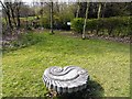
Wildflower Meadow, Benwell Nature Park
Image: © Andrew Curtis
Taken: 23 Mar 2012
0.09 miles
2
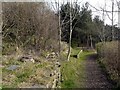
Benwell Nature Park
Hedgerows, walls, rock outcrops, scrub and coniferous woodland all created from wasteland by community volunteers.
Image: © Andrew Curtis
Taken: 23 Mar 2012
0.10 miles
3
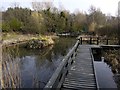
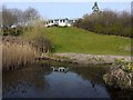
Ponds, Benwell Nature Park
As there is no natural spring to provide a continuous supply of water, all the water for the ponds comes from rainfall collected and channelled from the park building above, and filtered through a settling pond and reed bed.
Image: © Andrew Curtis
Taken: 23 Mar 2012
0.12 miles
5
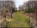
The Old Road, Benwell Nature Park
The old road is all that is left of the cobbled back lane that ran between the backs of the terraced houses of Atkinson Road and Helen Street, built for factory workers around 1905. The nature part also includes the site of Joan Street built in 1903. The houses were demolished in 1977. The cobbled surface was left as a demonstration of plants ability to colonise man-made surfaces. The bank on the right hand side, beyond the trees, was constructed with limestone rocks from Marsden Quarry in Co. Durham to provide additional habitats for lime-loving grassland plants such as rock-rose, field scabious and bloody cranesbill. The surrounding woodland was planted with a range of native deciduous trees which are still only just over 20 years old.
Image: © Andrew Curtis
Taken: 23 Mar 2012
0.14 miles
6
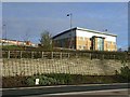
New office block, Scotswood Road
One example of the regeneration of this former industrial area along the north bank of the River Tyne. This block is occupied by Barratt's builders. Seen from Hadrians Wall National Trail http://www.nationaltrail.co.uk/hadrianswall/
Image: © Oliver Dixon
Taken: 18 Nov 2008
0.15 miles
9
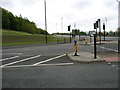
A junction on the A695 Scotswood Road, at Paradise
'Paradise' may feel a rather optimistic description of the location these days. The picture was taken while walking Hadrian's Wall Path.
Image: © David Purchase
Taken: 24 May 2013
0.18 miles
10
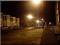
Atkinson Road
Just south of Benwell Lane at Adelaide Terrace.
Image: © Stephen Sweeney
Taken: 12 Jan 2009
0.19 miles