
IMAGES TAKEN NEAR TO
Teindland Close, NEWCASTLE UPON TYNE, NE4 8HE
Introduction
This page details the photographs taken nearby to Teindland Close, NE4 8HE by members of the Geograph project.
The Geograph project started in 2005 with the aim of publishing, organising and preserving representative images for every square kilometre of Great Britain, Ireland and the Isle of Man.

There are currently over 7.5m images from over14,400 individuals and you can help contribute to the project by visiting https://www.geograph.org.uk
Image Map
Images are licensed for reuse under creativecommons.org/licenses/by-sa/2.0
Notes
- Clicking on the map will re-center to the selected point.
- The higher the marker number, the further away the image location is from the centre of the postcode.
Image Listing (24 Images Found)
Images are licensed for reuse under creativecommons.org/licenses/by-sa/2.0
Image
Details
Distance
1

John Buddle Work Village, Benwell
The John Buddle Work Village provides office and workshop accommodation for small business units.
The website http://www.johnbuddleworkvillage.org provided the following information:
"The development of this centre follows 5 years of hard work by the 'Reviving the Heart of the West End' partnership. Set up in 1997, our clear remit was to bring the regeneration of the West End of the City of Newcastle to the forefront of the agenda for the creation of employment opportunities for residents and the community as a whole.
'Reviving the Heart of the West End' registered as a community charitable trust in 2002 and following successful bids in 2000 and 2003, a funding package of £2.9m was secured to develop and build the John Buddle Work Village, offering office and workshop accommodation as part of the CityWest development.
The Work Village is named after John Buddle, a prominent local mining engineer, who using his entrepreneurial skills invented and developed the means of mining coal deeply and therefore began the industrial development of the area in the early 1800’s. Widely recognised as an international consultant, he is said to have been a 'friend of the poor and a zealous promoter and supporter of charitable and scientific institutes'."
Image: © Andrew Curtis
Taken: 23 Mar 2012
0.06 miles
2
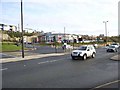
Scotswood Road, Newcastle
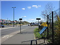
A695, one of the main roads out of Newcastle to the west. The traffic signals are at the junction with William Armstrong Drive. The footway on the south side of the road carries Hadrian's Way, the local name for the traffic-free route along the Tyne through Newcastle. The Way is followed by both Hadrian's Wall National Trail http://www.nationaltrail.co.uk/hadrianswall/ and by route 72 of the National Cycle Network (Hadrian's Cycleway
http://www.cycle-routes.org/HADRIANSCYCLEWAY/and the Tynemouth branch of the C2C Cycle Route http://www.c2c-guide.co.uk/).
Image: © Oliver Dixon
Taken: 18 Nov 2008
0.16 miles
3
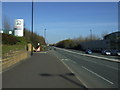
Scotswood Road (A695)
Heading east into Newcastle.
Image: © JThomas
Taken: 2 May 2013
0.17 miles
4
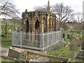
Elaborate tomb, St John's Cemetery, Elswick, Newcastle upon Tyne
The tomb of the Mather family in St John's Cemetery, Elswick. The degraded stonework is protected behind a fence. The structure is grade II listed (link: https://historicengland.org.uk/listing/the-list/list-entry/1320365).
Image: © Graham Robson
Taken: 6 Dec 2017
0.17 miles
5
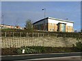
New office block, Scotswood Road
One example of the regeneration of this former industrial area along the north bank of the River Tyne. This block is occupied by Barratt's builders. Seen from Hadrians Wall National Trail http://www.nationaltrail.co.uk/hadrianswall/
Image: © Oliver Dixon
Taken: 18 Nov 2008
0.17 miles

8
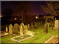
Gravestones in Elswick Cemetery
One of the larger cemeteries in Newcastle. Just off Elswick Road.
Image: © Stephen Sweeney
Taken: 12 Jan 2009
0.19 miles
9
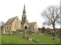
Chapels in St John's Cemetery, Elswick, Newcastle upon Tyne
The pair of chapels located in the middle of St John's Cemetery, Elswick. The chapels are in a dilapidated state with the entrance and space under the central arch fenced off. The chapels are grade II listed (link: http://historicengland.org.uk/listing/the-list/list-entry/1024893).
Image: © Graham Robson
Taken: 6 Dec 2017
0.21 miles
10
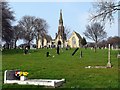
St John's Cemetery, Elswick
Chapels and archway, c1856, designed by Johnstone and Knowles. A Grade II Listed Building https://historicengland.org.uk/listing/the-list/list-entry/1024893
Image: © Andrew Curtis
Taken: 23 Mar 2012
0.21 miles