
IMAGES TAKEN NEAR TO
Swinburn, HEXHAM, NE48 4DF
Introduction
This page details the photographs taken nearby to NE48 4DF by members of the Geograph project.
The Geograph project started in 2005 with the aim of publishing, organising and preserving representative images for every square kilometre of Great Britain, Ireland and the Isle of Man.

There are currently over 7.5m images from over14,400 individuals and you can help contribute to the project by visiting https://www.geograph.org.uk
Image Map
Images are licensed for reuse under creativecommons.org/licenses/by-sa/2.0
Notes
- Clicking on the map will re-center to the selected point.
- The higher the marker number, the further away the image location is from the centre of the postcode.
Image Listing (14 Images Found)
Images are licensed for reuse under creativecommons.org/licenses/by-sa/2.0
Image
Details
Distance
1

Gatehouse to the Hermitage, Barrasford
In 2008 - Image]
Image: © JThomas
Taken: 10 Oct 2021
0.00 miles


4

Old Milestone by the A6079, east of Barrasford, Chollerton parish
Carved stone post by the A6079, in parish of Chollerton (Tynedale District), East of Barrasford, South of stone gate arch, on grass verge, on North side of road. Rothbury stone, erected by the Alemouth & Hexham, Western part turnpike trust in the 18th century.
Inscription reads:-
: R.B / 24 : : H / 7 :
(To Rothbury and Hexham)
Northumberland HER.
Reference number: N16769 https://www.heritagegateway.org.uk/Gateway/Results_Single.aspx?uid=N16769&resourceID=110
Milestone Society National ID: NB_RBHX24
Image: © IA Davison
Taken: 1 May 2001
0.07 miles
5

Milestone by the A6079 southwest of Wood Hall Farm
The location of this milestone is shown in Image The inscriptions indicate that from here it is 24 miles (NNE) to Rothbury and 7 miles (south) to Hexham. There is a similar milestone one mile further to the northeast Image
Image: © Mike Quinn
Taken: 6 Apr 2013
0.08 miles
6

Woodland by the A6079 southwest of Wood Hall Farm
Shows the location of Image
Image: © Mike Quinn
Taken: 6 Apr 2013
0.09 miles
7
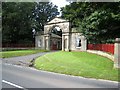
Gatehouse to the Hermitage, Barrasford
This fine gatehouse stands at the entrance of the drive up to the Hermitage off the A6079.
Image: © Oliver Dixon
Taken: 11 Sep 2008
0.09 miles

10
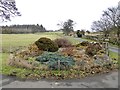
Rock Garden
At the foot of the drive to Wood Hall Farm.
Image: © Oliver Dixon
Taken: 14 Feb 2019
0.13 miles