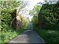
IMAGES TAKEN NEAR TO
West Woodburn, HEXHAM, NE48 2RF
Introduction
This page details the photographs taken nearby to NE48 2RF by members of the Geograph project.
The Geograph project started in 2005 with the aim of publishing, organising and preserving representative images for every square kilometre of Great Britain, Ireland and the Isle of Man.

There are currently over 7.5m images from over14,400 individuals and you can help contribute to the project by visiting https://www.geograph.org.uk
Image Map
Images are licensed for reuse under creativecommons.org/licenses/by-sa/2.0
Notes
- Clicking on the map will re-center to the selected point.
- The higher the marker number, the further away the image location is from the centre of the postcode.
Image Listing (10 Images Found)
Images are licensed for reuse under creativecommons.org/licenses/by-sa/2.0
Image
Details
Distance
1
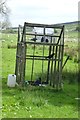
Larsen trap
Larsen traps were designed by a Danish gamekeeper in the 1950s.
Larsen traps will catch all corvid pest species (ie. crows, magpies, jackdaws, jays, rooks) at all times of the year, but their particular value is in catching crows and magpies when they set up their breeding territories.
Image: © Russel Wills
Taken: 1 Jun 2017
0.04 miles
2

Derelict building near Parkside
Just off the approach road to the old West Woodburn tip. The summits of Darney Crag and Hart Side are visible in the distance.
Image: © Pete Saunders
Taken: 6 Oct 2007
0.14 miles
3

Landfill Site
West woodburn closed landfill site
Image: © peter maddison
Taken: 19 Nov 2010
0.16 miles
4
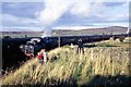
Last train to West Woodburn, the Wansbeck Piper
Steam had had its day! And so had most branch lines.
43063 and 43000 back to back headed an 11 coach train to make a final journey on old North British Railway line that originally ran from Morpeth to Reedsmouth near Bellingham. In this shot 430063 runs around the train, 43000 already at the front for the return journey.
More about the line at; www.cumberlandnews.co.uk/memories-of-when-steam-was-king-1.713705?referrerPath=home/2.3080
Image: © Chris Morgan
Taken: 2 Oct 1966
0.20 miles
5
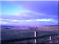
Looking NNW from The Broom
Looking towards the River Rede Valley, the wooded cleft dead centre from the grounds of The Broom
Image: © Nick Scott
Taken: 27 Dec 2005
0.21 miles
7
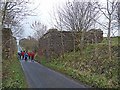
Bridge abutments on the old "Wannie" line
These bridge abutments stand on the hillside above East Woodburn and once carried the Wansbeck Valley Railway (the "Wannie") which ran from Redesmouth to Morpeth via Scots Gap. This part of the line was opened in 1865; the line was finally closed for all traffic in 1966.
Image: © Oliver Dixon
Taken: 17 Nov 2010
0.22 miles
8
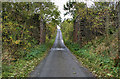
East Woodburn
Dismantled railway bridge above East Woodburn.
Image: © Peter McDermott
Taken: 20 Oct 2009
0.23 miles
9
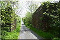
Bridge abutments on the old Wansbeck Railway
Between the old Woodburn and Knowesgate stations.
Image: © Russel Wills
Taken: 1 Jun 2017
0.23 miles