
IMAGES TAKEN NEAR TO
Falstone, HEXHAM, NE48 1BB
Introduction
This page details the photographs taken nearby to NE48 1BB by members of the Geograph project.
The Geograph project started in 2005 with the aim of publishing, organising and preserving representative images for every square kilometre of Great Britain, Ireland and the Isle of Man.

There are currently over 7.5m images from over14,400 individuals and you can help contribute to the project by visiting https://www.geograph.org.uk
Image Map
Images are licensed for reuse under creativecommons.org/licenses/by-sa/2.0
Notes
- Clicking on the map will re-center to the selected point.
- The higher the marker number, the further away the image location is from the centre of the postcode.
Image Listing (12 Images Found)
Images are licensed for reuse under creativecommons.org/licenses/by-sa/2.0
Image
Details
Distance
1
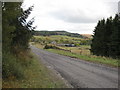
Hawkhope
See Keys to the Past website: http://www.keystothepast.info/durhamcc/K2P.nsf/K2PDetail?readform&PRN=N6963 .
Image: © Pete Saunders
Taken: 24 Oct 2010
0.02 miles
2
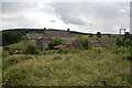
Hawkhope
Hawkhope farm near Falstone.
Image: © Peter McDermott
Taken: 7 Jul 2007
0.03 miles
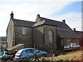
4
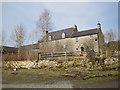
Hawkhope Farmhouse near Falstone
The farmhouse at Hawkhope has been built incorporating a 16th or 17th century bastle. The bastle measures about 12.7m by 7.6m and has exceptionally thick walls, up to 1.5m thick, built of roughly coursed stones. Another unusual feature is its height, as it has two storeys and an attic above. Some bastles were been heightened at a later date but this one appears to have been built to this height from the beginning. Inside the bastle are a few original features, such as a wall cupboard and a blocked window. The bastle was altered and enlarged in the 18th and 19th centuries. This is a Grade II Listed Building protected by law.
http://www.keystothepast.info/durhamcc/K2P.nsf/K2PDetail?readform&PRN=N6963
Image: © Les Hull
Taken: 10 Mar 2010
0.04 miles
5
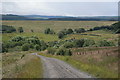
Hawkhope
View of Hawkhope amongst the trees as seen from the forest boundary. Kielder Dam is also prominent in this picture.
Image: © Peter McDermott
Taken: 7 Jul 2007
0.04 miles
6

Sculptural tree trunk at Hawkshope
Complete with a hobbit hole.
Image: © Oliver Dixon
Taken: 22 May 2023
0.05 miles

8

Dismantled Railway Line (Border Counties Railway)
Image: © Les Hull
Taken: 10 Mar 2010
0.07 miles

10

Hawkhope Burn
View looking up Hawkhope Burn at High Hawkhope on the edge of Kielder Forest.
Image: © Peter McDermott
Taken: 16 Feb 2008
0.12 miles