
IMAGES TAKEN NEAR TO
Falstone, HEXHAM, NE48 1AP
Introduction
This page details the photographs taken nearby to NE48 1AP by members of the Geograph project.
The Geograph project started in 2005 with the aim of publishing, organising and preserving representative images for every square kilometre of Great Britain, Ireland and the Isle of Man.

There are currently over 7.5m images from over14,400 individuals and you can help contribute to the project by visiting https://www.geograph.org.uk
Image Map
Images are licensed for reuse under creativecommons.org/licenses/by-sa/2.0
Notes
- Clicking on the map will re-center to the selected point.
- The higher the marker number, the further away the image location is from the centre of the postcode.
Image Listing (9 Images Found)
Images are licensed for reuse under creativecommons.org/licenses/by-sa/2.0
Image
Details
Distance
1

Rough grassland at Burnhead
Looking across a distance of rough grassland to the small farm at Burnhead.
Image: © Graham Robson
Taken: 30 Jan 2018
0.08 miles
2

The road to Slaty Ford
Cul de sac road over Thorneyburn Common. The clump of bushes is the bin store for Burnhead, just downhill to the left.
Image: © Oliver Dixon
Taken: 1 Sep 2021
0.09 miles
3
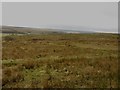
Rough grazing land at Burnhead
An expanse of rough upland grassland used for the grazing of sheep.
Image: © Graham Robson
Taken: 30 Jan 2018
0.11 miles
4

Thorneyburn Common
Sheepfold on Thorneyburn Common.
Image: © Peter McDermott
Taken: 16 Feb 2008
0.15 miles
5

A gate in the road
To the east of Burnhead a gate is closed across the road. The gate forms part of a boundary, which is largely a stone wall, dividing large areas of rough upland grazing land.
Image: © Graham Robson
Taken: 30 Jan 2018
0.19 miles
6

Road on Thorneyburn Common
Cul de sac road from Slaty Ford to Lanehead.
Image: © Oliver Dixon
Taken: 1 Sep 2021
0.21 miles
7

Roadside sheep pens
Pens for the holding and sorting of sheep on the open hillside and beside the minor road to the west of Burnhead farm.
Image: © Graham Robson
Taken: 30 Jan 2018
0.23 miles
8

Sheepfold on Thorneyburn Common
North Tynedale in the distance.
Image: © Oliver Dixon
Taken: 1 Sep 2021
0.24 miles
9

The road to Slaty Ford
Cul de sac road over Thorneyburn Common. A sheepfold stands beside the road.
Image: © Oliver Dixon
Taken: 1 Sep 2021
0.25 miles