
IMAGES TAKEN NEAR TO
Skinnerburn Road, NEWCASTLE UPON TYNE, NE4 7AR
Introduction
This page details the photographs taken nearby to Skinnerburn Road, NE4 7AR by members of the Geograph project.
The Geograph project started in 2005 with the aim of publishing, organising and preserving representative images for every square kilometre of Great Britain, Ireland and the Isle of Man.

There are currently over 7.5m images from over14,400 individuals and you can help contribute to the project by visiting https://www.geograph.org.uk
Image Map
Images are licensed for reuse under creativecommons.org/licenses/by-sa/2.0
Notes
- Clicking on the map will re-center to the selected point.
- The higher the marker number, the further away the image location is from the centre of the postcode.
Image Listing (132 Images Found)
Images are licensed for reuse under creativecommons.org/licenses/by-sa/2.0
Image
Details
Distance
1

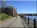
Environment Agency, Skinnerburn Road, Newcastle
Image: © Les Hull
Taken: 2 Nov 2010
0.02 miles
3

Environment agency
Looks quite new and is beside Hadrians way on the river Tyne.
Image: © Bill Nicholls
Taken: 27 Apr 2011
0.02 miles
4

View across the Tyne
Taken from across the River Tyne on the cycleway at Dunston Staithes in Gateshead. The buildings in the foreground are part of the Newcastle Business Park. Cruddas Park Flats Image in the background.
Image: © Vicki Deritis
Taken: 31 Oct 2009
0.03 miles
6

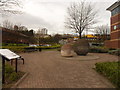
'Spheres', Riverside Walkway, Newcastle Upon Tyne
There are spheres at three different locations along the riverside walkway. These two are situated adjacent to the offices of the Environment Agency on Skinnerburn Road. Created in 1990 by Richard Cole for the Gateshead Garden Festival, these giant spheres are made up of layers of concrete rings of different sizes. The colours of the spheres vary as the aggregate used to make the concrete is exposed. Further spheres can be seen at https://www.geograph.org.uk/photo/1051320.
Image: © Geoff Holland
Taken: 1 Apr 2025
0.03 miles
7
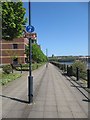
Hadrians way
Another cycleway under my belt, number 72 Hadrians way which runs beside the River Tyne.
Image: © Bill Nicholls
Taken: 27 Apr 2011
0.04 miles
8
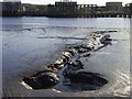
Tidal mud flats on the River Tyne
On the north shore, adjacent to Hadrian's Way. The Dunston Coal Staithes can be seen on the far side of the river, with the fire-damaged section visible.
Image: © Oliver Dixon
Taken: 18 Nov 2008
0.04 miles
9
Dirty information board
Information board about the Eastwick Riverbank area of the Tyne.
Image: © Bill Nicholls
Taken: 27 Apr 2011
0.04 miles
10
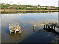
Derelict landing stage and the River Tyne opposite Dunston Staiths
For information about the coal staiths, see Image
Image: © Mike Quinn
Taken: 5 Sep 2018
0.06 miles