IMAGES TAKEN NEAR TO
Low Mill Cottages, HEXHAM, NE47 9QA
Introduction
This page details the photographs taken nearby to Low Mill Cottages, NE47 9QA by members of the Geograph project.
The Geograph project started in 2005 with the aim of publishing, organising and preserving representative images for every square kilometre of Great Britain, Ireland and the Isle of Man.

There are currently over 7.5m images from over14,400 individuals and you can help contribute to the project by visiting https://www.geograph.org.uk
Image Map
Images are licensed for reuse under creativecommons.org/licenses/by-sa/2.0
Notes
- Clicking on the map will re-center to the selected point.
- The higher the marker number, the further away the image location is from the centre of the postcode.
Image Listing (46 Images Found)
Images are licensed for reuse under creativecommons.org/licenses/by-sa/2.0
Image
Details
Distance
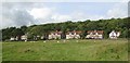
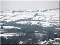
2
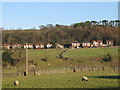
The Haining
Looking across the valley of the River East Allen from Thornley Gate towards the houses on Station Road.
Image: © Mike Quinn
Taken: 13 Dec 2007
0.13 miles
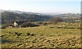
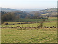
5
Lead smelting flue (9)
See Image (photo by Les Hull) for details of the Allendale lead smelting flue system.
Image: © Mike Quinn
Taken: 15 Jun 2010
0.14 miles
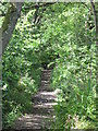
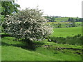
9
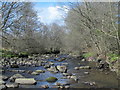
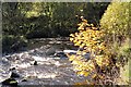
The River East Allen by Lowmill Haughs (2)
Looking downstream. See also Image
Image: © Mike Quinn
Taken: 15 Apr 2017
0.16 miles