IMAGES TAKEN NEAR TO
Allenheads, HEXHAM, NE47 9HY
Introduction
This page details the photographs taken nearby to NE47 9HY by members of the Geograph project.
The Geograph project started in 2005 with the aim of publishing, organising and preserving representative images for every square kilometre of Great Britain, Ireland and the Isle of Man.

There are currently over 7.5m images from over14,400 individuals and you can help contribute to the project by visiting https://www.geograph.org.uk
Image Map
Images are licensed for reuse under creativecommons.org/licenses/by-sa/2.0
Notes
- Clicking on the map will re-center to the selected point.
- The higher the marker number, the further away the image location is from the centre of the postcode.
Image Listing (35 Images Found)
Images are licensed for reuse under creativecommons.org/licenses/by-sa/2.0
Image
Details
Distance
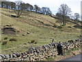
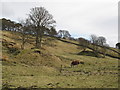
1
Pasture and woodland around Woodhead Cottage
Image: © Mike Quinn
Taken: 16 May 2019
0.07 miles
3
East Allen Dale north of Allenheads
Looking across the valley from close to Dodd reservoir towards the Image on the far hillside.
Image: © Mike Quinn
Taken: 9 Jan 2009
0.09 miles
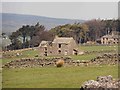
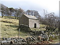
5
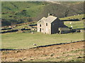
Ruined farmhouse above Allenheads
Photo taken from the track to Byerhope in Image
Image: © Mike Quinn
Taken: 16 Nov 2008
0.13 miles
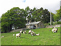
6
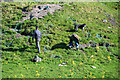
Catching Rabbits
Ferreting near Dirt Pot.
Image: © Peter McDermott
Taken: 26 Sep 2009
0.13 miles
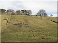
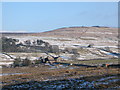
9

Old workings at Allenheads
Old spoil heap above High Shield.
Image: © Oliver Dixon
Taken: 8 Feb 2013
0.15 miles