IMAGES TAKEN NEAR TO
Allendale, HEXHAM, NE47 9EU
Introduction
This page details the photographs taken nearby to NE47 9EU by members of the Geograph project.
The Geograph project started in 2005 with the aim of publishing, organising and preserving representative images for every square kilometre of Great Britain, Ireland and the Isle of Man.

There are currently over 7.5m images from over14,400 individuals and you can help contribute to the project by visiting https://www.geograph.org.uk
Image Map
Images are licensed for reuse under creativecommons.org/licenses/by-sa/2.0
Notes
- Clicking on the map will re-center to the selected point.
- The higher the marker number, the further away the image location is from the centre of the postcode.
Image Listing (38 Images Found)
Images are licensed for reuse under creativecommons.org/licenses/by-sa/2.0
Image
Details
Distance
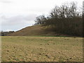
2
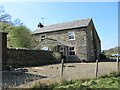
Kittygreen
Possibly once a farmhouse and now private residence and evidence of restoration work.
Image: © Les Hull
Taken: 20 Apr 2022
0.00 miles
4
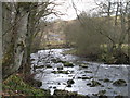
The River East Allen near Kittygreen (2)
Image: © Mike Quinn
Taken: 24 Feb 2008
0.03 miles
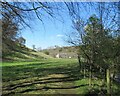
5
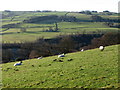
The valley of the River East Allen
Looking southwest from near Old Town across the valley towards High Frostall (backed by a small plantation) on the borders of Image and Image
Image: © Mike Quinn
Taken: 11 Dec 2007
0.06 miles
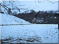
6
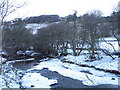
Frozen River East Allen east of Kittygreen (2)
Image: © Mike Quinn
Taken: 27 Dec 2010
0.07 miles
8
The River East Allen near Kittygreen (3)
Image: © Mike Quinn
Taken: 24 Feb 2008
0.07 miles
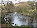
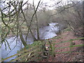
10
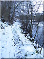
Snowy path on the south bank of the River East Allen
Image: © Mike Quinn
Taken: 27 Dec 2010
0.08 miles