IMAGES TAKEN NEAR TO
Allendale, HEXHAM, NE47 9AD
Introduction
This page details the photographs taken nearby to NE47 9AD by members of the Geograph project.
The Geograph project started in 2005 with the aim of publishing, organising and preserving representative images for every square kilometre of Great Britain, Ireland and the Isle of Man.

There are currently over 7.5m images from over14,400 individuals and you can help contribute to the project by visiting https://www.geograph.org.uk
Image Map
Images are licensed for reuse under creativecommons.org/licenses/by-sa/2.0
Notes
- Clicking on the map will re-center to the selected point.
- The higher the marker number, the further away the image location is from the centre of the postcode.
Image Listing (83 Images Found)
Images are licensed for reuse under creativecommons.org/licenses/by-sa/2.0
Image
Details
Distance
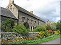
1
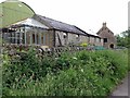
Roadside buildings at Low Broadwood Hall
Image: © Andrew Curtis
Taken: 23 Jun 2017
0.01 miles
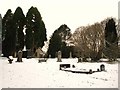
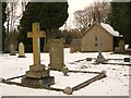
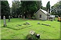
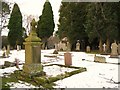
8
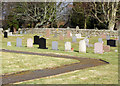
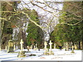
The cemetery
Allendale's cemetery, to the south-west of the town.
Image: © Helen Wilkinson
Taken: 27 Feb 2008
0.08 miles
10
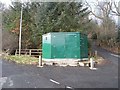
What's behind the green door?
Mystery structure above Bridge End, Allendale. The adjacent antenna suggests that whatever is in inside is being controlled remotely - or alternatively that whatever is being monitored is being relayed elsewhere.
Image: © Oliver Dixon
Taken: 7 Apr 2010
0.09 miles