IMAGES TAKEN NEAR TO
Whitfield, HEXHAM, NE47 8JE
Introduction
This page details the photographs taken nearby to NE47 8JE by members of the Geograph project.
The Geograph project started in 2005 with the aim of publishing, organising and preserving representative images for every square kilometre of Great Britain, Ireland and the Isle of Man.

There are currently over 7.5m images from over14,400 individuals and you can help contribute to the project by visiting https://www.geograph.org.uk
Image Map
Images are licensed for reuse under creativecommons.org/licenses/by-sa/2.0
Notes
- Clicking on the map will re-center to the selected point.
- The higher the marker number, the further away the image location is from the centre of the postcode.
Image Listing (13 Images Found)
Images are licensed for reuse under creativecommons.org/licenses/by-sa/2.0
Image
Details
Distance
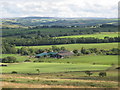
1
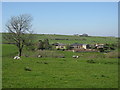
The Steel
East Steel on OL43. Shankhead in Image is on the horizon above the main farmhouse.
Image: © Mike Quinn
Taken: 2 May 2007
0.02 miles
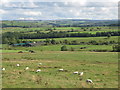
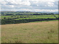
2
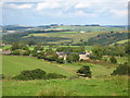
Farmland southwest of The Steel
Looking northeast across the cleugh of Kingswood Burn.
Image: © Mike Quinn
Taken: 18 Aug 2010
0.06 miles
3
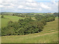
The wooded cleugh of Kingswood Burn west of The Steel
Image: © Mike Quinn
Taken: 18 Aug 2010
0.07 miles
4
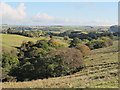
The wooded cleugh of Kingswood Burn west of The Steel (2)
Image: © Mike Quinn
Taken: 15 Oct 2012
0.08 miles
5
Farmland between Shankhead and The Steel (2)
Image: © Mike Quinn
Taken: 18 Aug 2010
0.09 miles
8
Farmland between Shankhead and The Steel
Image: © Mike Quinn
Taken: 18 Aug 2010
0.15 miles
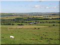
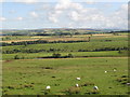
9
Farmland near Shankhead (2)
Looking east of south towards Image
Image: © Mike Quinn
Taken: 18 Aug 2010
0.16 miles
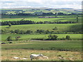
10
Rough pastures above Black Sike (2)
Looking towards Huntershield Farm in the southwest corner of Image
Image: © Mike Quinn
Taken: 30 Jul 2009
0.18 miles